Tornado Warning Issued for Northern Choctaw County
A tornado warning is in effect for northern Choctaw County in southwestern Alabama until 8:30 PM CST.
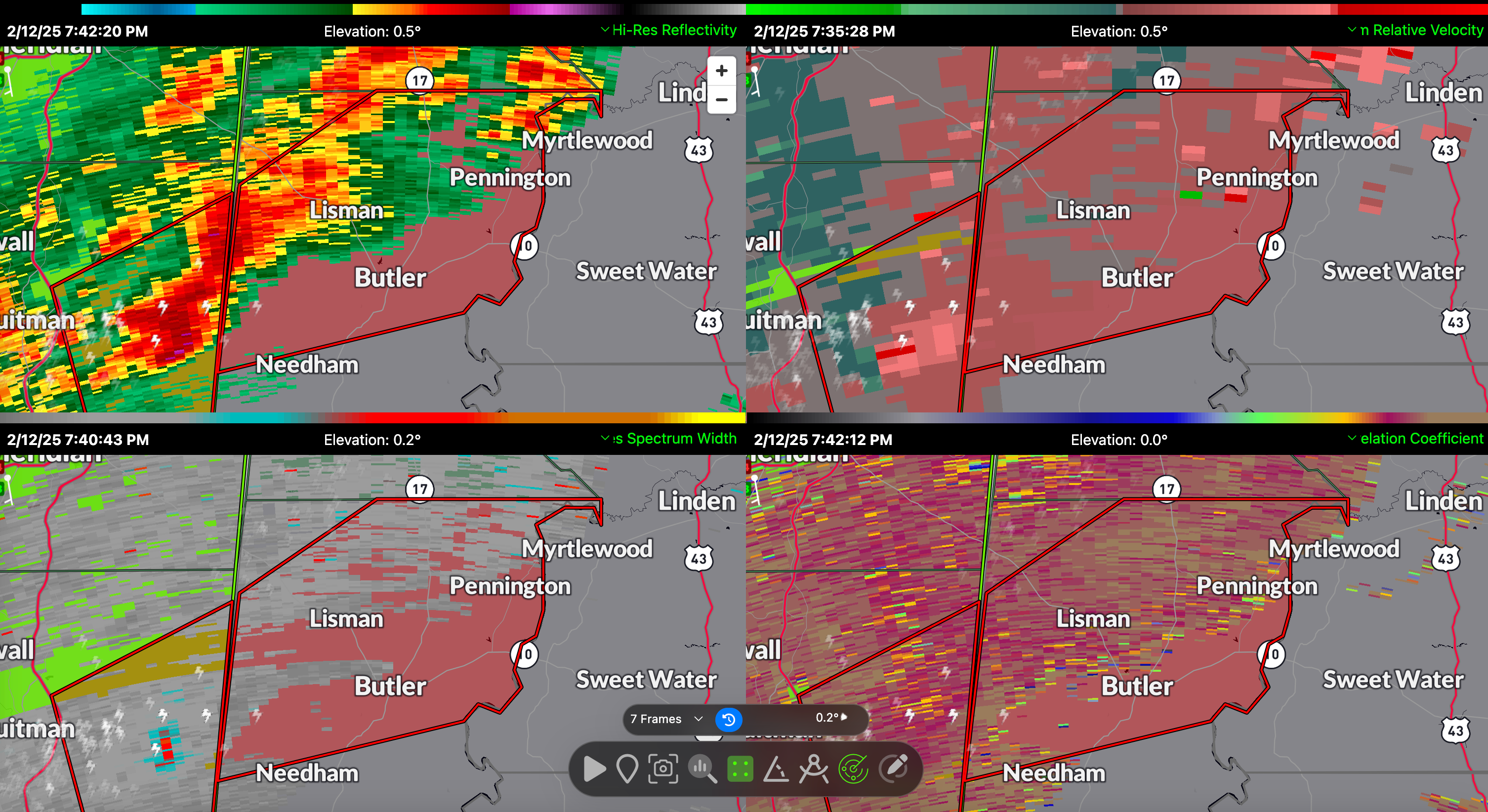
At 7:38 PM CST, a severe thunderstorm capable of producing a tornado was located near Crandall, or 9 miles east of Quitman, moving northeast at 40 mph. Radar has detected rotation, indicating the potential for a tornado.
Residents in and around Lisman should prepare for possible impacts around 8:05 PM CST. This storm has the potential to produce flying debris, damage to roofs, windows, and vehicles, and the destruction of mobile homes. Tree damage is also likely.
This warning is part of a larger severe weather event affecting Alabama, with conditions supporting rotating storms and an elevated tornado threat. Earlier mesoscale discussions highlighted increasing low-level wind shear and high moisture levels, creating a favorable environment for tornadoes, especially in storms tracking along the warm front.
If you are in the path of this storm, take cover immediately in an interior room on the lowest floor of a sturdy building. Avoid windows and protect yourself from flying debris. Tornadoes at night are difficult to see—do not wait for visual confirmation. Take action now.
Category: Alabama's Weather, ALL POSTS, Severe Weather, Social Media
About the Author (Author Profile)
Bill Murray is the President of The Weather Factory. He is the site's official weather historian and a weekend forecaster. He also anchors the site's severe weather coverage. Bill Murray is the proud holder of National Weather Association Digital Seal #0001 @wxhistorianSubscribe
If you enjoyed this article, subscribe to receive more just like it.


