Winter Weather Expected Tomorrow Night for North Alabama: Timing, Impacts, and More
Tuesday night will bring another round of winter weather to parts of the state – so here is the latest on what we expect to see Tuesday night and early Wednesday morning. This is a deep dive post where I will be evaluating new model data.
Temperature will be the deciding factor when it comes to how far south snow will fall. Overnight Tuesday, temperatures across the northern portion of the state will fall below freezing. However, they must do so before or during any precipitation in order to snow to fall. Right now, the general consensus of the models is that precipitation will begin around 1am, and continue through around 8am. Here is a look at modeled temperatures at 12am, 3am, and 6am:
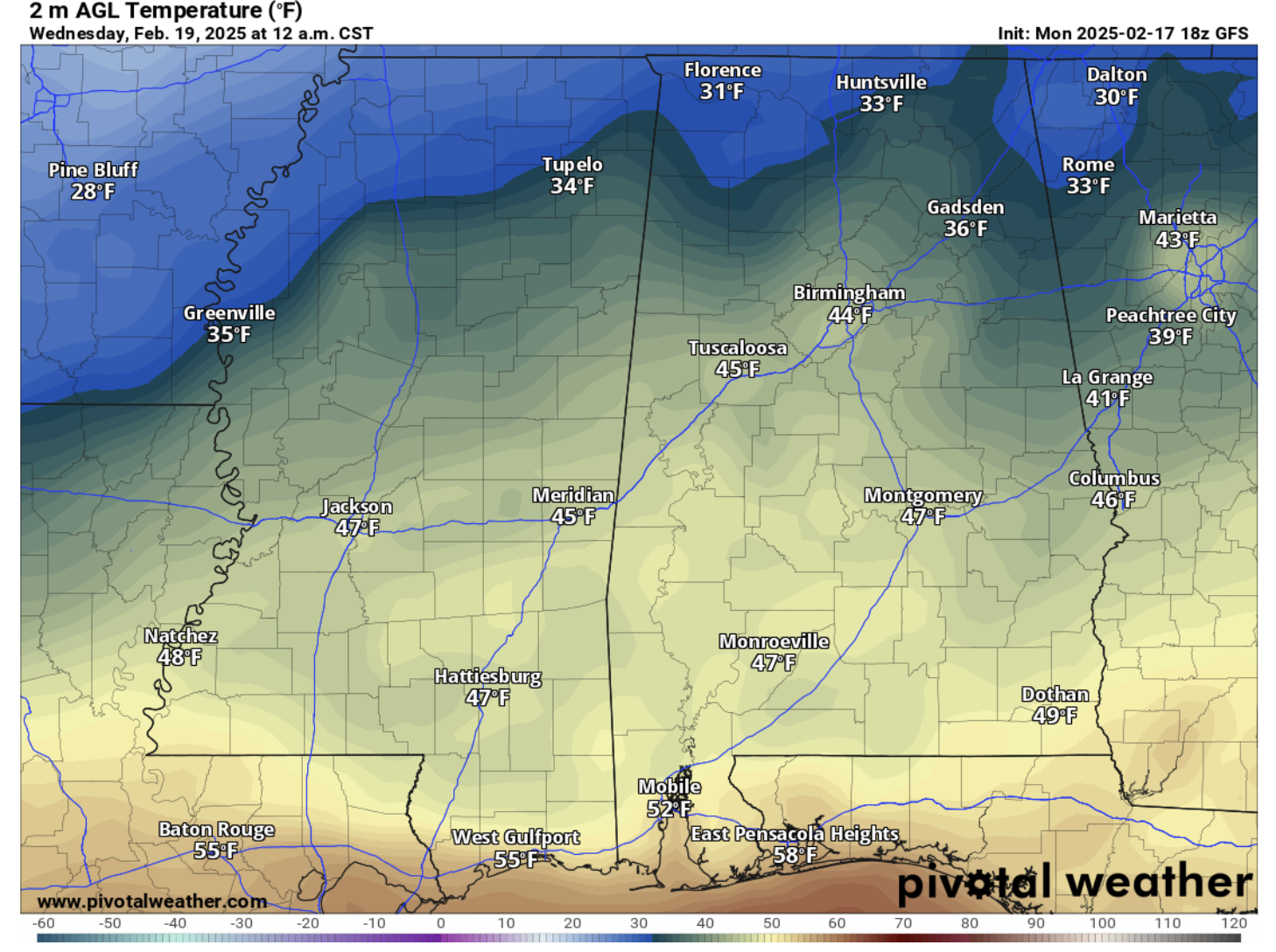
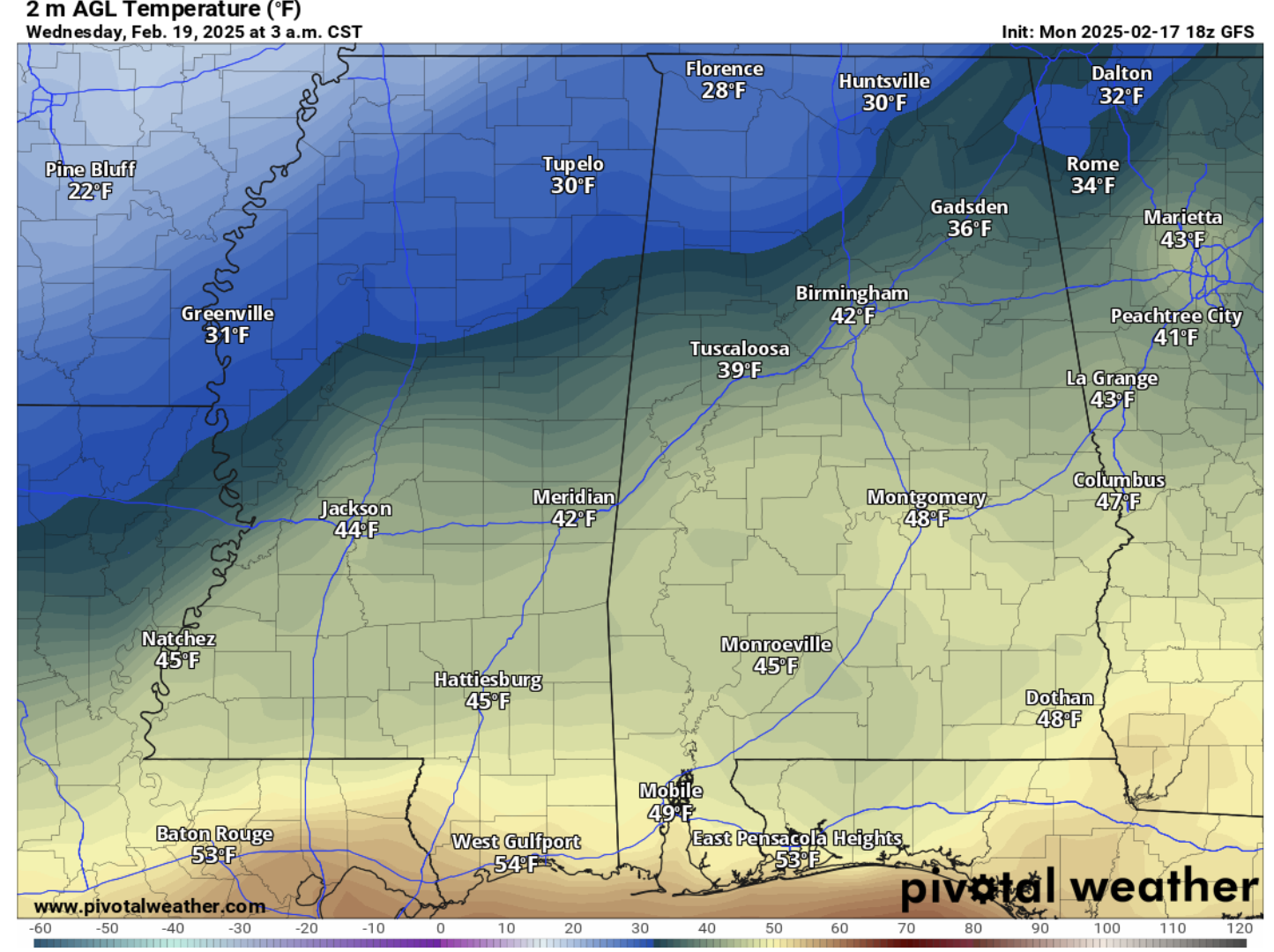
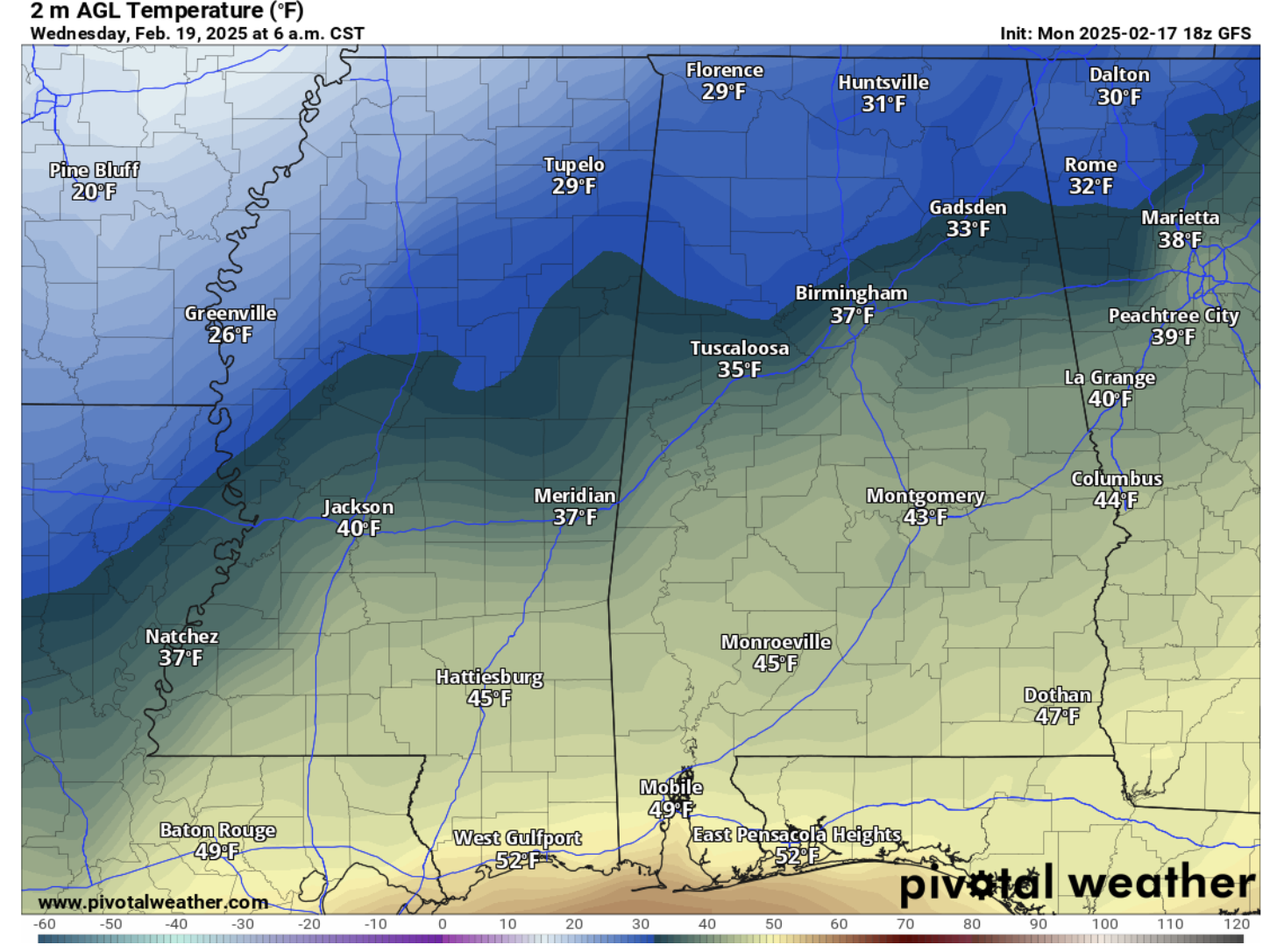
The GFS shows only a few northwest counties being under freezing at midnight right as the precipitation will move into the state. Then, around 3am, the line of freezing temperatures drops down into Marion and Winston Counties, and up to the Huntsville area. Finally, around 6am, temperatures across northern AL (just shy of Birmingham) drop below freezing. It is important to remember that this fine line will continue to shift with new model runs, but the main takeaway from current model data shows that the freezing line will run between Birmingham and Gadsden. Areas south of this line will receive rain and areas north will receive snow. Ice accumulation is not expected to be a major issue.
Here is a look at the GFS precipitation types for 3am and 6am:
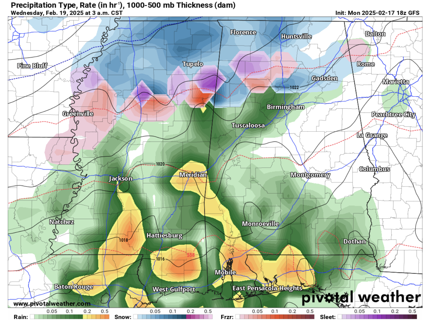
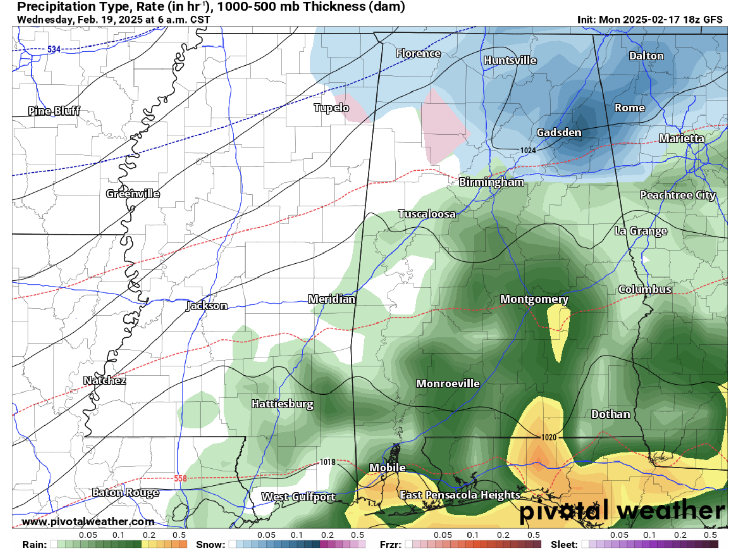
As mentioned earlier, this precipitation will enter the state around 1am and will move out of our area around 8am. During this time, snowfall is expected in areas that can drop below freezing. In Southern AL, this will be a typical rain event.
Finally, here is a look at snowfall totals from the GFS and EURO models:
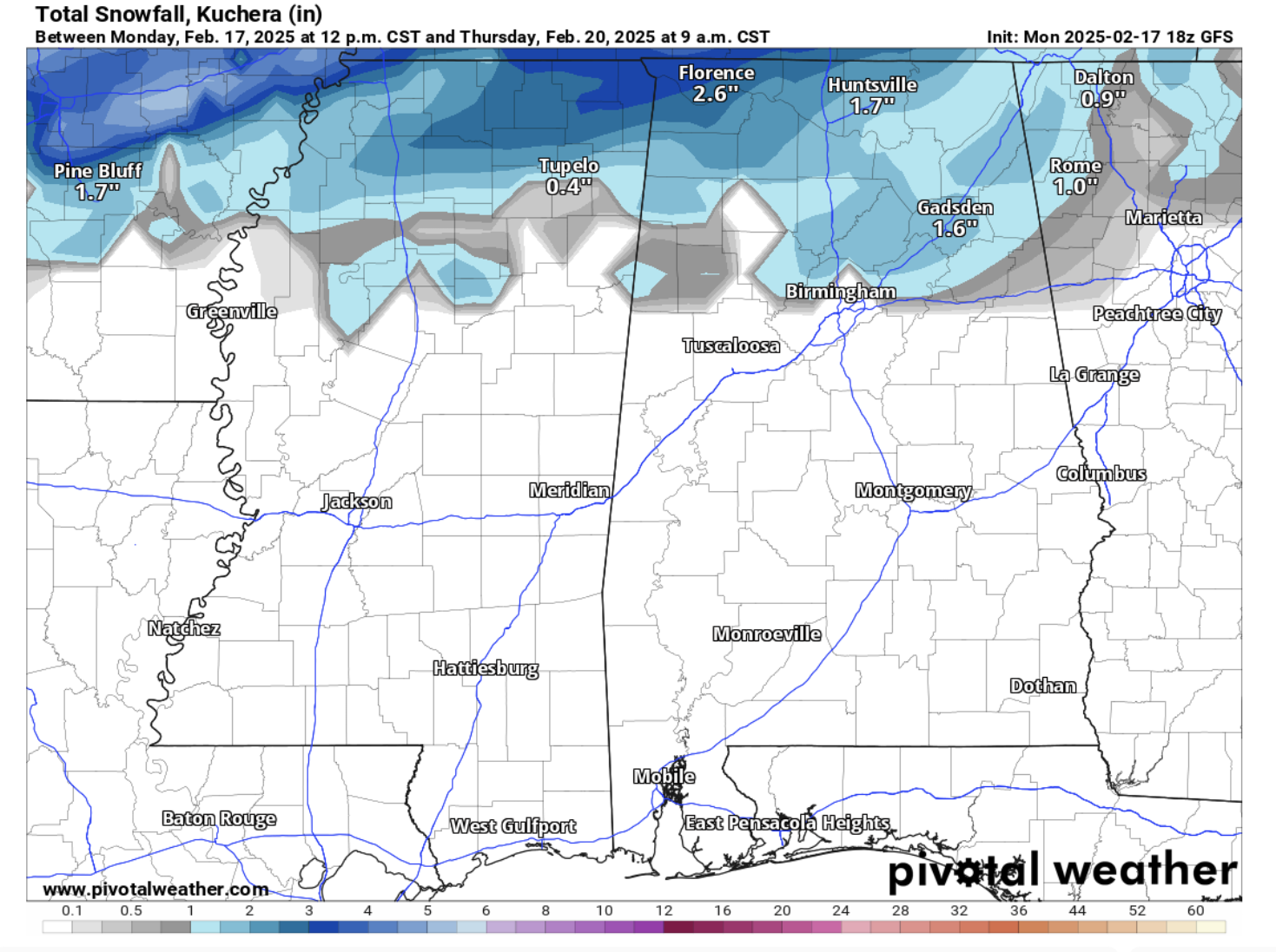
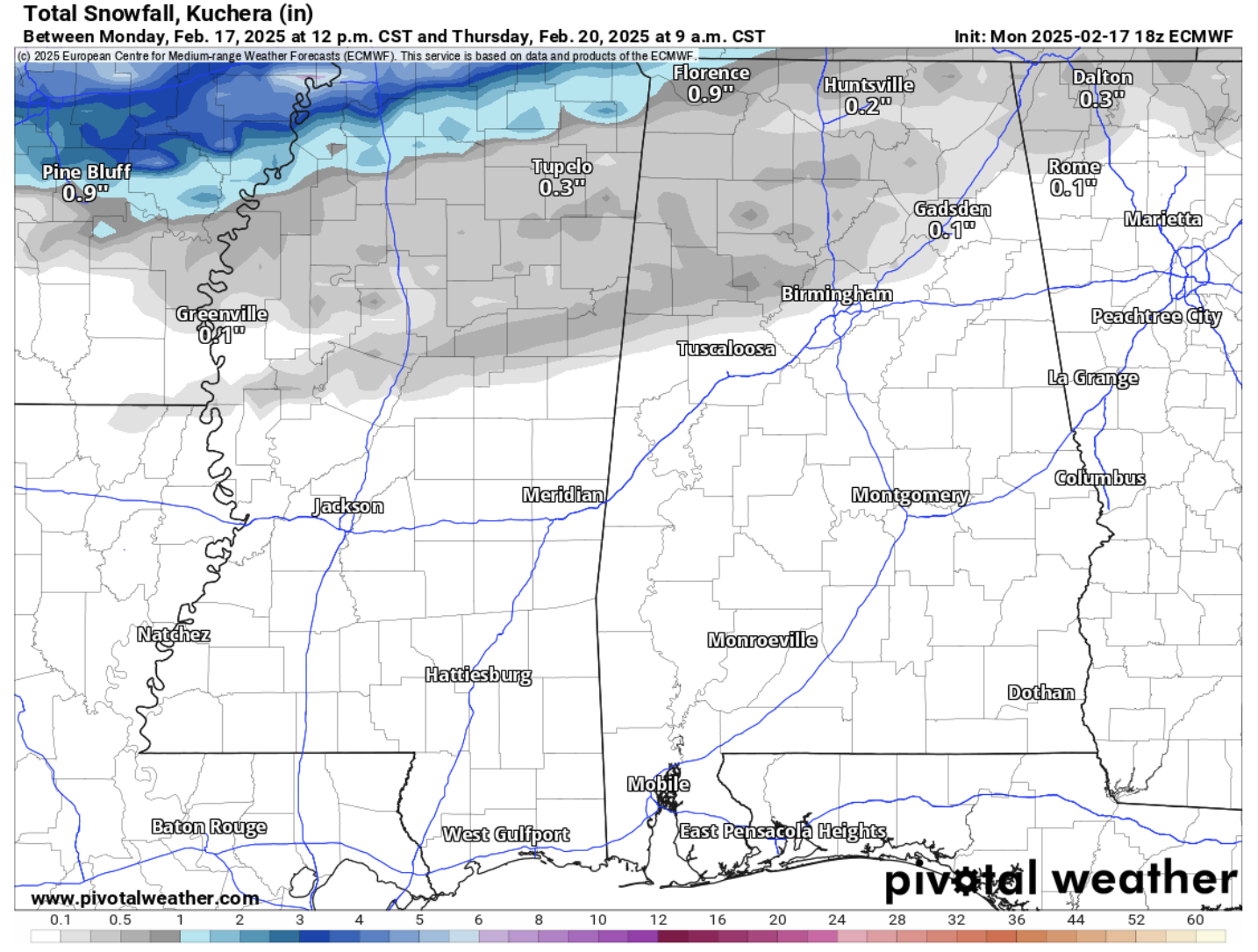
Both models are showing snow accumulation as far south as the previously mentioned line between Birmingham and Gadsden, but they are quite different in terms of total snow amount. The GFS shows between 0.5 to 2.5 inches of snow, while the EURO shows less than an inch.
Stay tuned for updates as we iron out all the details of this forecast!
Category: Alabama's Weather, ALL POSTS, Social Media, Winter Weather
About the Author (Author Profile)
Scott is a senior at Mississippi State University studying professional and broadcast meteorology.Subscribe
If you enjoyed this article, subscribe to receive more just like it.


