2 Additional Tornadoes Confirmed In Northern Alabama From Weekend Storms
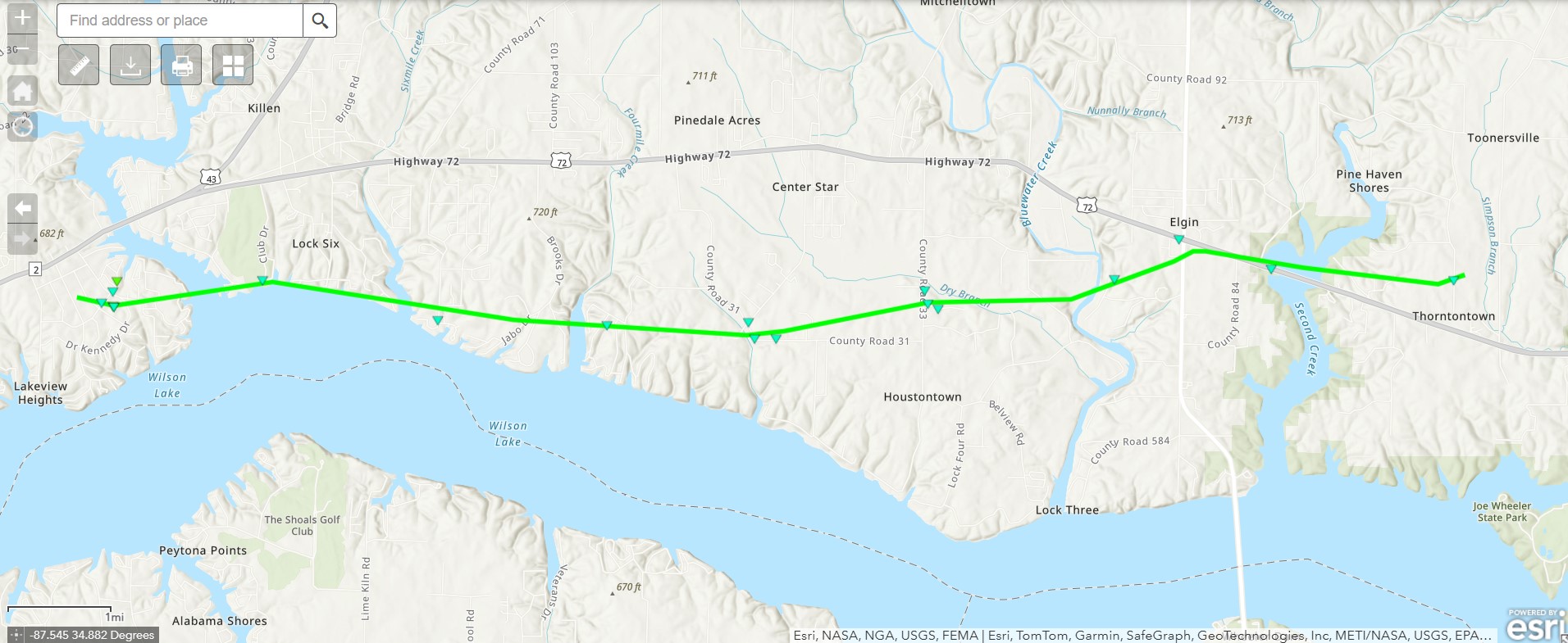
2 more tornadoes were confirmed from the weekend severe weather event, both in northern AL. This one was confirmed to have occured along Wilson Lake. Here are the results from the storm survey completed by NWS Huntsville:
Rating:                 EF1
Estimated Peak Wind:    94 mph
Path Length /statute/:  13.42 miles
Path Width /maximum/:   250 yards
Fatalities:             0
Injuries:               0

Start Date:             02/15/2025
Start Time:             11:22 PM CST
Start Location:         3 WSW Killen / Lauderdale County / AL
Start Lat/Lon:          34.841 / -87.5765

End Date:               02/15/2025
End Time:               11:33 PM CST
End Location:           3 WNW Rogersville / Lauderdale County / AL
End Lat/Lon:            34.8441 / -87.3441

Survey Summary:
An NWS survey team, with assistance from Lauderdale County EMA,
surveyed damage in southern Lauderdale County, near Wilson Lake,
which was consistent with an EF-1 tornado. Maximum winds were 94
MPH.

The tornado initially touched down in the vicinity of Myrtle
Road (in the Kendale Gardens subdivision) where it produced the
only structural damage observed by the survey team. This
structural damage was due to a large, uprooted hardwood tree
falling into the front portion of a residence. The tornado then
traveled eastward, crossing the mouth of Shoal Creek and far
northern extent of Wilson Lake before moving back onshore and
producing tree damage along the southern portion of Lingerlost
Road. Afterwards, the tornado moved generally eastward across
rural portions of southern Lauderdale County (north of Wilson Lake
and south of U.S. Highway 72), producing clusters of tree damage
on Lauderdale C.R. 31 and in the general vicinity of the
intersection of Lauderdale C.R. 33 and Walnut Creek Road. From
this point, the tornado headed east-northeastward, crossing
Bluewater Creek and producing sporadic tree damage in Elgin and
along the western shore of Second Creek. The tornado lifted along
Lauderdale C.R. 53 (north of Thorntontown), where tree damage was
also observed.
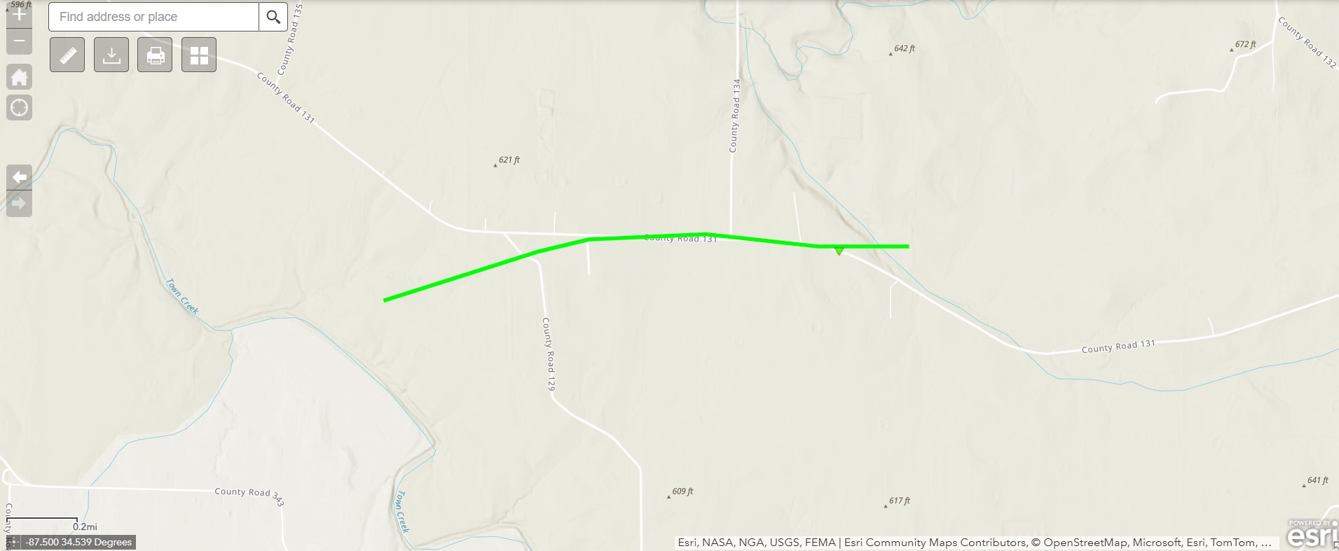
The NWS confirmed an additional tornado from the weekend severe weather event near Hatton Alabama. Here are the results of that survey:
Rating:                 EF1
Estimated Peak Wind:    95 mph
Path Length /statute/:  1.50 miles
Path Width /maximum/:   150 yards
Fatalities:             0
Injuries:               0

Start Date:             02/15/2025
Start Time:             11:33 PM CST
Start Location:         9 SSW Town Creek / Lawrence County / AL
Start Lat/Lon:          34.5487 / -87.4985

End Date:               02/17/2025
End Time:               11:34 PM CST
End Location:           9 SSW Town Creek / Lawrence County / AL
End Lat/Lon:            34.5509 / -87.4727

Survey Summary:
NWS Huntsville and Lawrence Co. EMA determined damage near
Hatton, AL was attributed to an EF-1 tornado with maximum of
95 MPH.The tornado, embedded in a line of severe thunderstorms,
was only briefly on the ground for approximately 1.5 miles. The
tornado likely touched down west of CR 129, and damage was
observed near CR 129 and along CR 131. Damage indicators were
mainly a mix of snapped and uprooted trees and farm outbuildings.
Damage was tracked eastward along CR 131 and likely lifted west
of CR 132.
Category: Alabama's Weather, ALL POSTS, Social Media
About the Author (Author Profile)
Jack is a junior at Mississippi State University studying meteorology. He has several years of forecasting experience through a local group of forecasters in Maryland where he resides. Jack plans to become a broadcast meteorologist after graduation.Subscribe
If you enjoyed this article, subscribe to receive more just like it.


