Update on Tonight’s Winter Precipitation in North Alabama
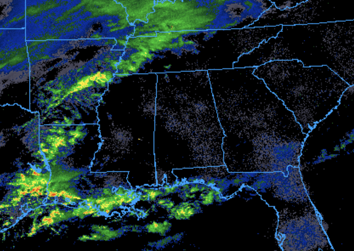
Right now, the system that has the potential to bring snow to Northern Alabama is currently moving across the Mississippi River and into Western Tennessee. Here is a look at current radar:
We have received numerous reports of snowfall already occurring in other areas. An inch of snow has been reported in many TN cities: Martin, Dyersburg, and Clarksville. Currently, graupel is falling in Dickson, TN. Currently, there is a mesoscale discussion regarding this snowfall in Western TN. Here is the graphic from this discussion:
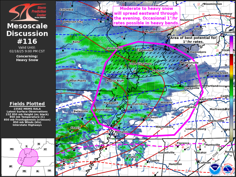
The SPC notes that snowfall rates of up to 1 inch per hour are possible in this area for the next couple of hours, followed by light snowfall later tonight.
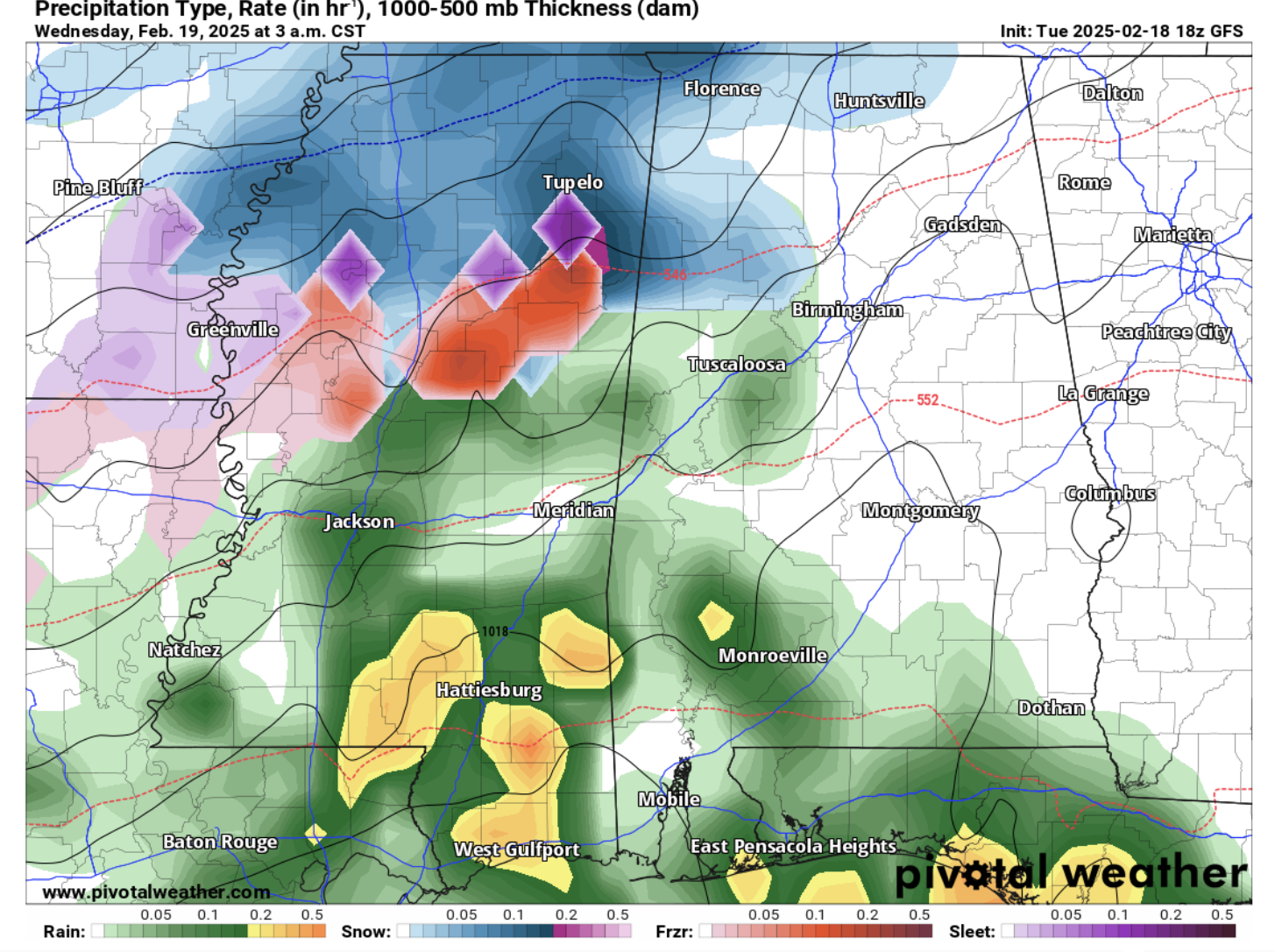
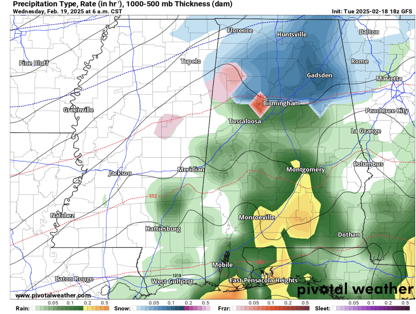
The latest run of the GFS shows this system moving into Alabama around 2am, then leaving our area around 8am tomorrow. Here are the 3am and 6am precipitation graphs from the GFS:
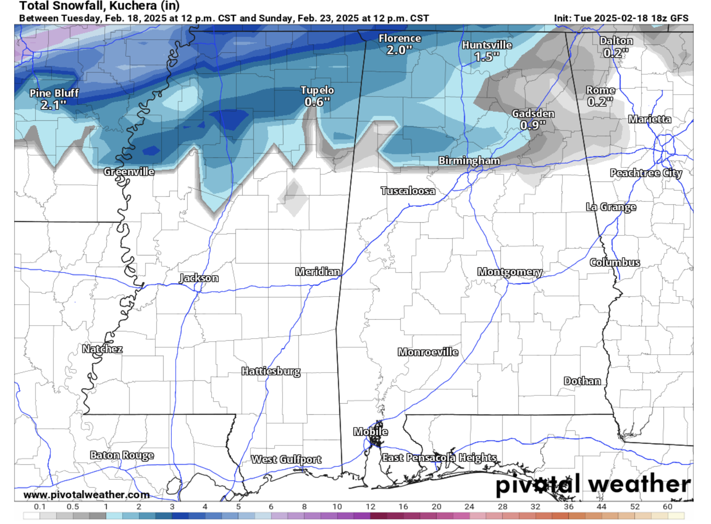
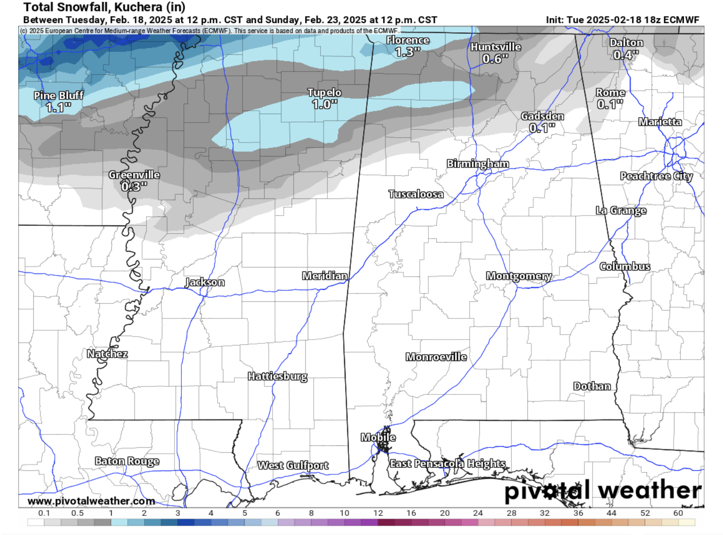
Based on an analysis of multiple different models, it appears that up to 2 inches of snow is possible for areas north of Birmingham, with the highest snowfall amounts occurring in the extreme northern portion of the state. Here are images of snowfall totals from the GFS and EURO models:
Category: Alabama's Weather, ALL POSTS, Social Media, Winter Weather
About the Author (Author Profile)
Scott is a senior at Mississippi State University studying professional and broadcast meteorology.Subscribe
If you enjoyed this article, subscribe to receive more just like it.


