Severe Thunderstorm Warning In Effect For Franklin, Colbert, And Lauderdale Counties Until 6:30pm
UPDATE: This warning has been upgraded to a considerable tag for the possibility of hail as large as tennis balls. This is a dangerous storm that could result in broken windows and car windows as well. Please remain indoors and away from windows!
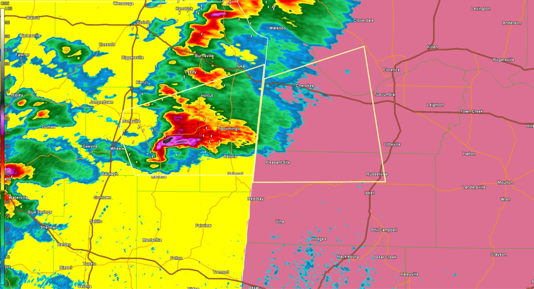
The National Weather Service in Huntsville Alabama has issued a

* Severe Thunderstorm Warning for...
  South central Lauderdale County in northwestern Alabama...
  Southwestern Colbert County in northwestern Alabama...
  Northwestern Franklin County in northwestern Alabama...

* Until 630 PM CDT.

* At 525 PM CDT, a severe thunderstorm was located near Burton, or 9
  miles southeast of Booneville, moving east at 40 mph.

  HAZARD...Ping pong ball size hail and 60 mph wind gusts.

  SOURCE...Radar indicated.

  IMPACT...People and animals outdoors will be injured. Expect hail
           damage to roofs, siding, windows, and vehicles. Expect
           wind damage to roofs, siding, and trees.

* Locations impacted include...
  Malone, Posey Loop, Pogo, Mt Hester, Cedar Creek Reservoir,
  Cherokee, Srygley Church, New Bethel, Allsboro, and Maud.

PRECAUTIONARY/PREPAREDNESS ACTIONS...

For your protection move to an interior room on the lowest floor of a
building.
Category: Alabama's Weather, ALL POSTS, Social Media
About the Author (Author Profile)
Jack is a junior at Mississippi State University studying meteorology. He has several years of forecasting experience through a local group of forecasters in Maryland where he resides. Jack plans to become a broadcast meteorologist after graduation.Subscribe
If you enjoyed this article, subscribe to receive more just like it.


