A Quick Look at the Alabama Severe Weather Situation at 1:35 p.m.
SEVERE STORMS EXPECTED THIS AFTERNOON AND EVENING ACROSS CENTRAL ALABAMA
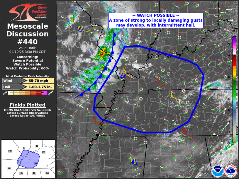
A developing line of thunderstorms will pose a severe weather risk for much of Central Alabama beginning late this afternoon and continuing through the overnight hours. The greatest threats will be damaging winds up to 60 mph and large hail up to quarter size. While an isolated tornado can’t be completely ruled out, the setup today primarily supports a hail and wind-driven event. The Storm Prediction Center maintains a Level 2 (Slight Risk) over a broad swath of the region, with a Level 1 (Marginal Risk) surrounding it.
METEOROLOGICAL SETUP
A broad upper-level trough is deepening over the eastern U.S., with multiple shortwaves rotating through its base. The most impactful of these is swinging southeastward across the Ohio and Tennessee Valleys and will interact with a surface cold front sagging into Alabama later today. Daytime heating has already led to steepening lapse rates, and modest low-level moisture is gradually increasing from the southwest. Mixed-layer CAPE values of 1000–1500 J/kg will develop this afternoon, aided by cold temperatures aloft and mid-level drying. Effective bulk shear values of 40–55 knots and relatively straight hodographs support the development of organized multicells and occasional supercells, especially during the first few hours after initiation.
SEVERE THUNDERSTORM TIMING
Storms are expected to develop and intensify between 5 PM and 1 AM as the front pushes into Central Alabama. Based on current mesoscale trends and high-resolution model guidance, here’s the breakdown of expected timing:
- North of Birmingham (Hamilton, Cullman, Gadsden, Anniston): 5–9 PM
- Clanton, Demopolis, Alex City corridor: 8–11 PM
- Montgomery, Selma, Auburn, Troy, Eufaula: 10 PM – 1 AM
Storms may initially form as discrete cells with hail potential, but will likely consolidate into clusters or line segments capable of producing scattered damaging wind gusts. Some small bowing structures may form, enhancing wind threat locally.
IMPACTS
Residents across Central Alabama should prepare for possible downed trees and power outages, particularly in areas that see stronger wind gusts. Vehicles left outside are at risk for minor hail damage, especially in the early phases of storm development when isolated supercells could briefly form. Outdoor plans this evening, including high school sports and community events, could be disrupted or delayed due to lightning and the threat of severe weather.
LOOKING AHEAD
Once this evening’s round clears the area by early Friday morning, another weak front will slide through Friday afternoon, bringing mainly showers with limited instability. Cooler and drier air will follow for the weekend, with a chance of patchy frost in northern valleys by Sunday morning. But the main focus for now is this afternoon and evening, when damaging storms will be most impactful.
Category: Alabama's Weather, ALL POSTS, Severe Weather, Social Media
About the Author (Author Profile)
Bill Murray is the President of The Weather Factory. He is the site's official weather historian and a weekend forecaster. He also anchors the site's severe weather coverage. Bill Murray is the proud holder of National Weather Association Digital Seal #0001 @wxhistorianSubscribe
If you enjoyed this article, subscribe to receive more just like it.


