Severe Thunderstorm Warning For Etowah County Until 6pm
The National Weather Service in Birmingham has issued a
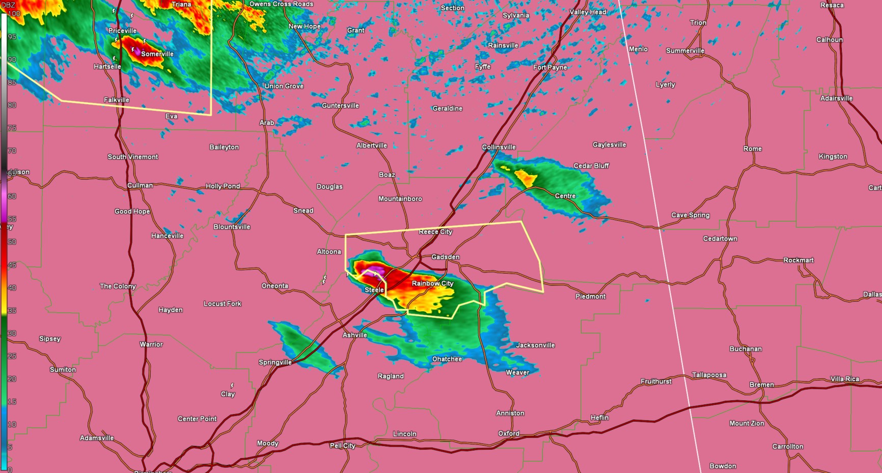
* Severe Thunderstorm Warning for...
Central Etowah County in northeastern Alabama...
* Until 600 PM CDT.
* At 456 PM CDT, a severe thunderstorm was located near Steele, or
near Attalla, moving east at 30 mph.
HAZARD...60 mph wind gusts and quarter size hail.
SOURCE...Radar indicated.
IMPACT...Hail damage to vehicles is expected. Expect wind damage
to roofs, siding, and trees.
* Locations impacted include...
Glencoe, Gadsden Steam Plant, Big Wills Creek, Hokes Bluff, Rainbow
City, Howelton, Ballplay, Southside, Gallant, Gadsden Municipal
Airport, Gadsden Mall, Gadsden, Cobb City, Reece City, Attalla,
Gadsden Water Works, Northside, Noccalula Falls, Reaves, and
Ramsey.
PRECAUTIONARY/PREPAREDNESS ACTIONS...
For your protection move to an interior room on the lowest floor of a
building.
Category: Alabama's Weather, ALL POSTS, Social Media
About the Author (Author Profile)
Jack is a junior at Mississippi State University studying meteorology. He has several years of forecasting experience through a local group of forecasters in Maryland where he resides. Jack plans to become a broadcast meteorologist after graduation.Subscribe
If you enjoyed this article, subscribe to receive more just like it.


