Severe Thunderstorm Warning In Effect For Cherokee County Until 6:15pm
The National Weather Service in Birmingham has issued a
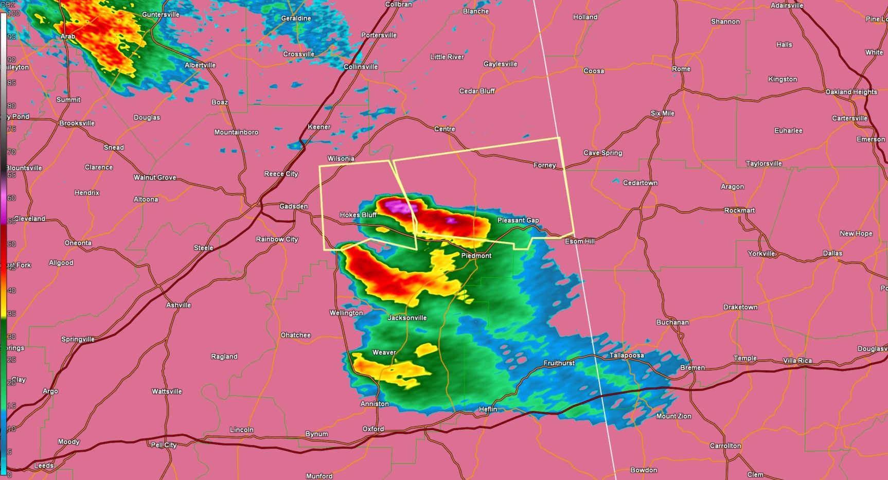
* Severe Thunderstorm Warning for...
Southern Cherokee County in northeastern Alabama...
* Until 615 PM CDT.
* At 526 PM CDT, a severe thunderstorm was located over Ball Flat, or
near Hokes Bluff, moving east at 45 mph.
HAZARD...60 mph wind gusts and quarter size hail.
SOURCE...Public.
IMPACT...Hail damage to vehicles is expected. Expect wind damage
to roofs, siding, and trees.
* Locations impacted include...
Coloma, Pleasant Gap, Tennala, Forney, Moshat, Ball Flat, Spring
Garden, Piedmont, and Eastern Weiss Lake.
PRECAUTIONARY/PREPAREDNESS ACTIONS...
For your protection move to an interior room on the lowest floor of a
building.
Category: Alabama's Weather, ALL POSTS, Social Media
About the Author (Author Profile)
Jack is a junior at Mississippi State University studying meteorology. He has several years of forecasting experience through a local group of forecasters in Maryland where he resides. Jack plans to become a broadcast meteorologist after graduation.Subscribe
If you enjoyed this article, subscribe to receive more just like it.


