Considerable Tagged Severe Thunderstorm Warning For Etowah County Until 6:45pm
The National Weather Service in Birmingham has issued a
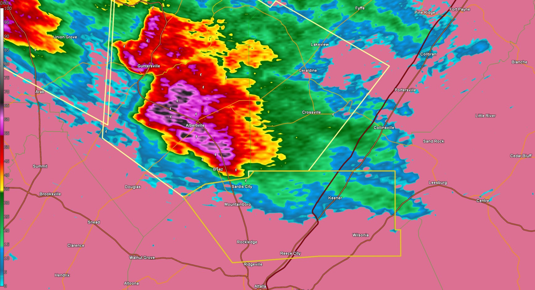
* Severe Thunderstorm Warning for...
Northeastern Etowah County in northeastern Alabama...
* Until 645 PM CDT.
* At 552 PM CDT, a severe thunderstorm was located over Boaz, moving
east at 35 mph.
HAZARD...Golf ball size hail and 60 mph wind gusts.
SOURCE...Radar indicated.
IMPACT...People and animals outdoors will be injured. Expect hail
damage to roofs, siding, windows, and vehicles. Expect
wind damage to roofs, siding, and trees.
* Locations impacted include...
Black Creek, Reece City, Sardis City, Wilsonia, Crudup, Tabor Road,
Mountainboro, Keener, Rockledge, Aurora, and Gadsden.
PRECAUTIONARY/PREPAREDNESS ACTIONS...
For your protection move to an interior room on the lowest floor of a
building.
Category: Alabama's Weather, ALL POSTS, Social Media
About the Author (Author Profile)
Jack is a junior at Mississippi State University studying meteorology. He has several years of forecasting experience through a local group of forecasters in Maryland where he resides. Jack plans to become a broadcast meteorologist after graduation.Subscribe
If you enjoyed this article, subscribe to receive more just like it.


