Considerable Tagged Severe Thunderstorm Warning For Etowah And Cherokee Counties
The National Weather Service in Birmingham has issued a
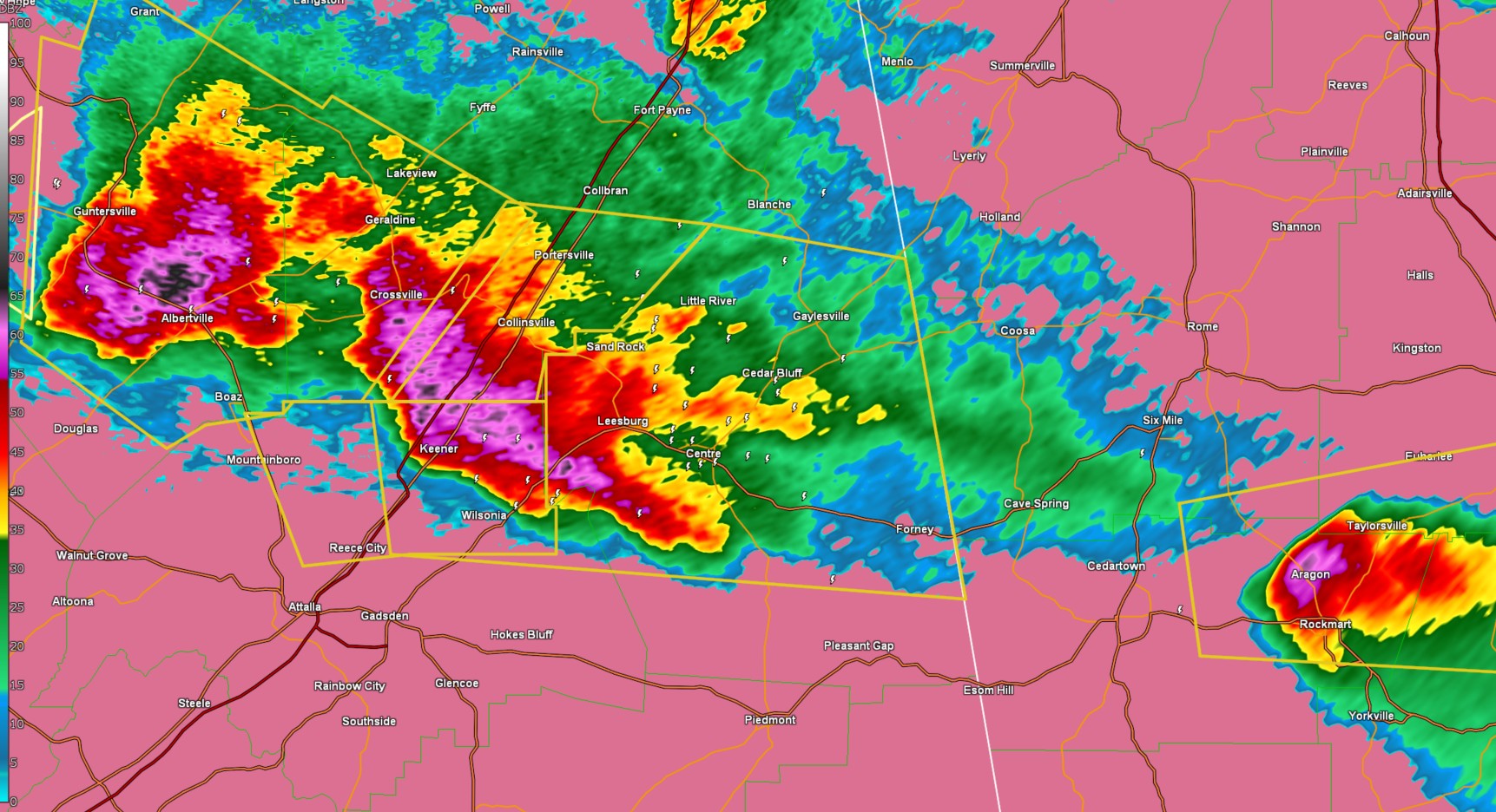
* Severe Thunderstorm Warning for...
Northeastern Etowah County in northeastern Alabama...
Cherokee County in northeastern Alabama...
* Until 730 PM CDT.
* At 621 PM CDT, a severe thunderstorm was located over Tabor Road,
or 12 miles west of Centre, moving east at 35 mph.
HAZARD...Golf ball size hail and 60 mph wind gusts.
SOURCE...Public.
IMPACT...People and animals outdoors will be injured. Expect hail
damage to roofs, siding, windows, and vehicles. Expect
wind damage to roofs, siding, and trees.
* Locations impacted include...
Coloma, Weiss Dam, Tennala, Leesburg, Tabor Road, Yellow Creek
Falls, Cherokee Rock Village, Cornwall Furnace Park, Eastern Weiss
Lake, Forney, Cedar Bluff, Fullerton, Keener, Centre Municipal
Airport, Slackland, Chesnut Bay Resort, Gaylesville, Centre,
Western Weiss Lake, and Black Creek.
PRECAUTIONARY/PREPAREDNESS ACTIONS...
For your protection move to an interior room on the lowest floor of a
building.
Category: Alabama's Weather, ALL POSTS, Social Media
About the Author (Author Profile)
Jack is a junior at Mississippi State University studying meteorology. He has several years of forecasting experience through a local group of forecasters in Maryland where he resides. Jack plans to become a broadcast meteorologist after graduation.Subscribe
If you enjoyed this article, subscribe to receive more just like it.


