Storm Threat Intensifying over North Jefferson
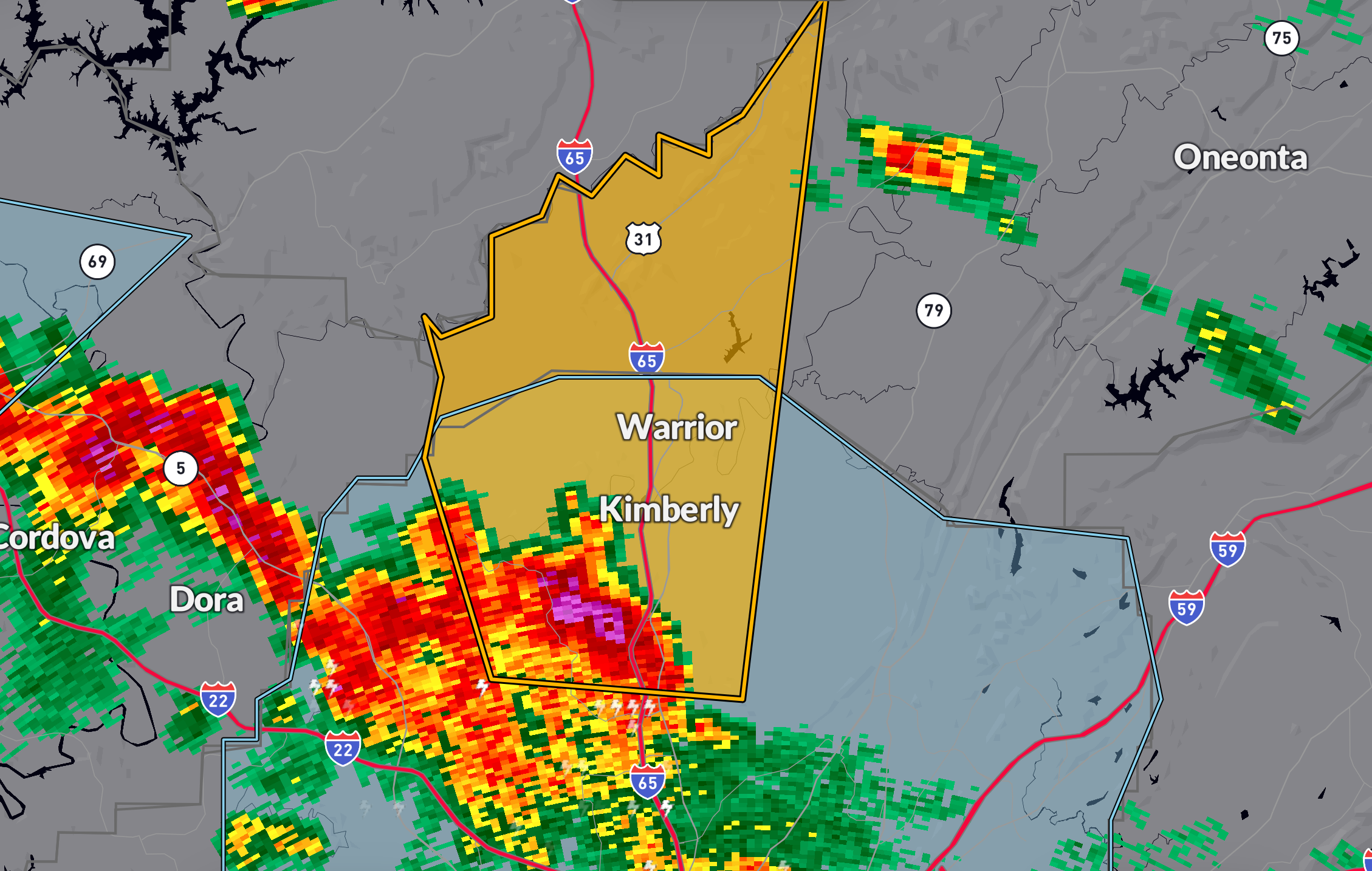
The core on the north Jefferson County cell has really ramped up aloft, prompting a Severe Thunderstorm Warning for quarter-size hail and 60 mph winds. This warning is in effect through 4:15 PM for northern Jefferson and southwestern Blount counties.
At 3:16 PM, the storm was centered near Morris, moving north at 15 mph. Radar indicates a strong updraft, suggesting enhanced hail potential.
Expected impacts:
…Hail damage to vehicles
…Wind damage to trees, roofs, and siding
Communities at risk include Gardendale, Kimberly, Hayden, Smoke Rise, Rickwood Caverns, and Partridge Crossroads.
Take shelter in an interior room on the lowest floor and stay there until the storm passes.
Category: Alabama's Weather, ALL POSTS, Severe Weather, Social Media
About the Author (Author Profile)
Bill Murray is the President of The Weather Factory. He is the site's official weather historian and a weekend forecaster. He also anchors the site's severe weather coverage. Bill Murray is the proud holder of National Weather Association Digital Seal #0001 @wxhistorianSubscribe
If you enjoyed this article, subscribe to receive more just like it.


