Severe Storm Moving Northeast Across Parts of Central Alabama
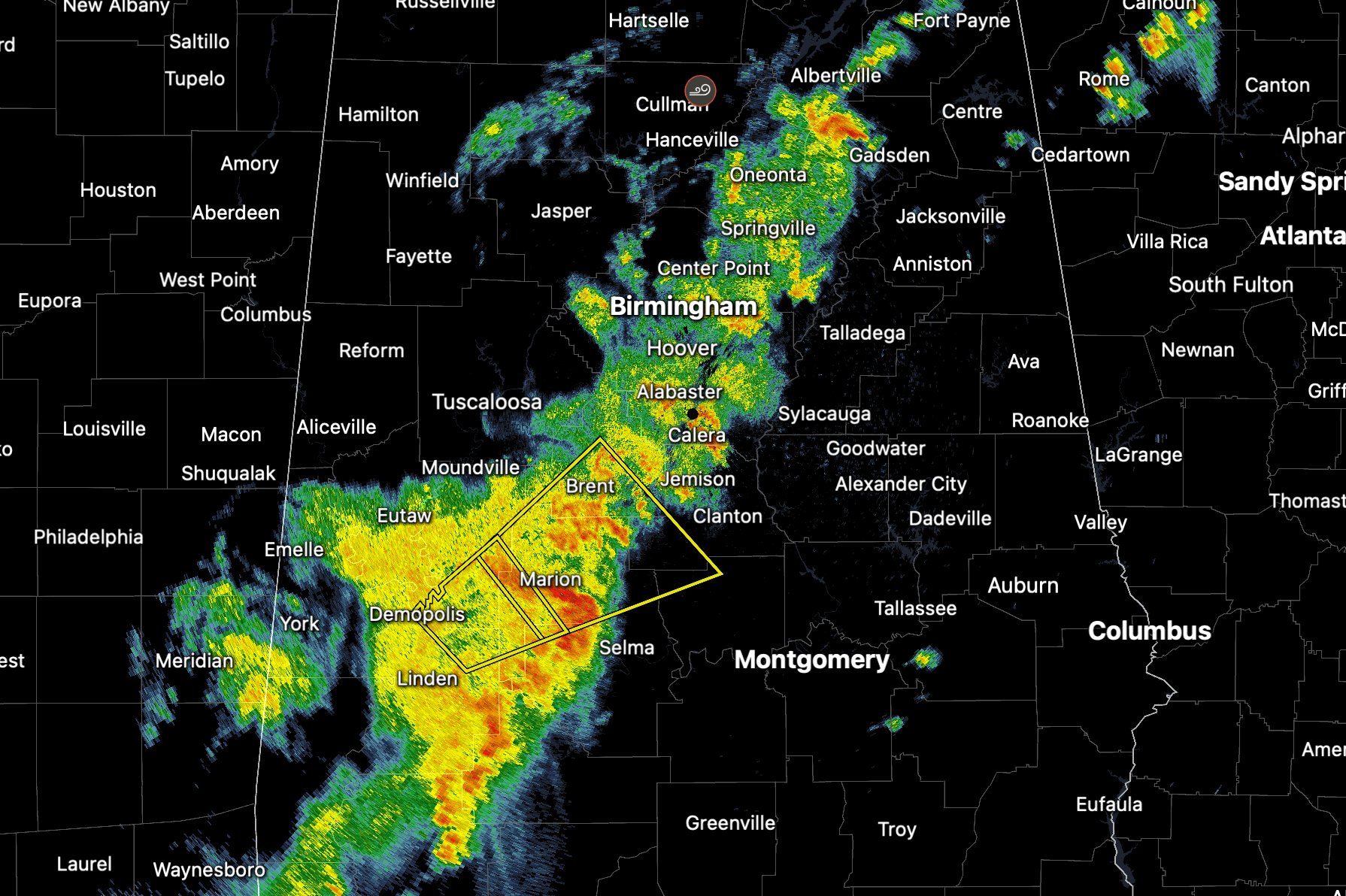
A severe thunderstorm warning is in effect until 5:45 PM for northwestern Autauga, southwestern Chilton, Perry, east central Hale, southern Bibb, and northern Dallas counties. At 4:56 PM, the storm was located over Marion, moving northeast at 40 mph. Radar indicates the potential for 60 mph wind gusts with this storm, which could cause damage to roofs, siding, and trees.
Locations at risk include Greensboro, Centreville, Maplesville, Plantersville, Stanton, and surrounding communities. Hail is not expected to be a major factor with this storm, with radar suggesting hail sizes under three-quarters of an inch.
This activity is associated with a broader area of showers and storms developing along an advancing cold front and outflow boundary. Additional showers and isolated storms are expected into the evening as this boundary continues eastward toward Georgia and the Carolinas.
Take shelter in an interior room until the storm passes.
We will not have warning by warning posts for this event so make sure you have you warning sources in alert mode.
Category: Alabama's Weather, ALL POSTS, Severe Weather, Social Media
About the Author (Author Profile)
Bill Murray is the President of The Weather Factory. He is the site's official weather historian and a weekend forecaster. He also anchors the site's severe weather coverage. Bill Murray is the proud holder of National Weather Association Digital Seal #0001 @wxhistorianSubscribe
If you enjoyed this article, subscribe to receive more just like it.


