Severe Thunderstorm Warning For Fayette, Marion, And Lamar Counties Until 3:30pm
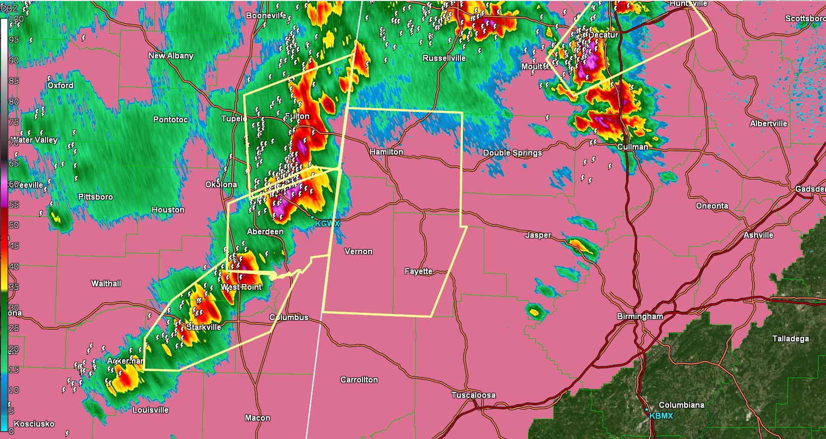
The National Weather Service in Birmingham has issued a

* Severe Thunderstorm Warning for...
  Marion County in northwestern Alabama...
  Fayette County in west central Alabama...
  Lamar County in west central Alabama...

* Until 330 PM CDT.

* At 216 PM CDT, severe thunderstorms were located along a line
  extending from near Fairview to 7 miles southeast of Amory to near
  Waverly, moving east at 35 mph.

  HAZARD...60 mph wind gusts and nickel size hail.

  SOURCE...Radar indicated.

  IMPACT...Expect damage to roofs, siding, and trees.

* Locations impacted include...
  Cody, Detroit, Henson Springs, Wayside, Richard Arthur Field,
  Rankin Fite Airport, Fayette, Upper Bear Creek Reservoir, Guin,
  Pine Springs, Marion County Public Lake, Hightogy, Piney Grove,
  Crossville, Bluff, Bazemore, Blooming Grove, Tessner, Millport, and
  Shottsville.

PRECAUTIONARY/PREPAREDNESS ACTIONS...

For your protection move to an interior room on the lowest floor of a
building.
Category: Alabama's Weather, ALL POSTS, Social Media
About the Author (Author Profile)
Jack is a junior at Mississippi State University studying meteorology. He has several years of forecasting experience through a local group of forecasters in Maryland where he resides. Jack plans to become a broadcast meteorologist after graduation.Subscribe
If you enjoyed this article, subscribe to receive more just like it.


