Severe Thunderstorm Warning For Fayette, Lamar, Marion, Walker, And Winston Counties
The National Weather Service in Birmingham has issued a
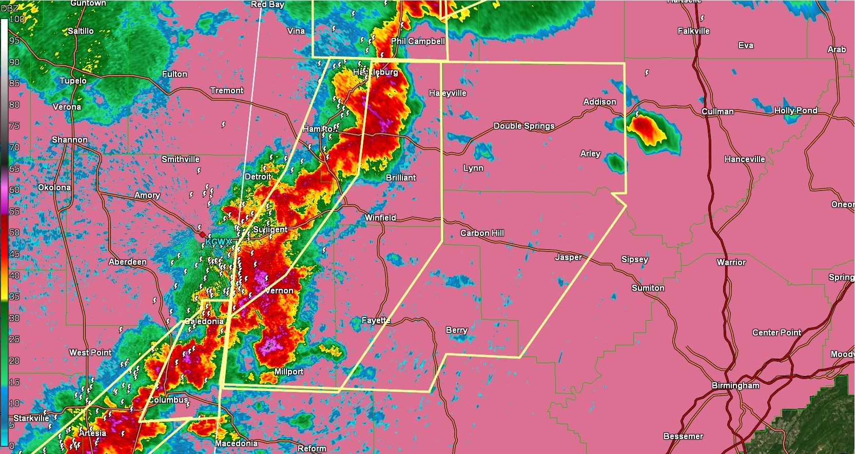
* Severe Thunderstorm Warning for...
Western Walker County in central Alabama...
Eastern Marion County in northwestern Alabama...
Winston County in northwestern Alabama...
Fayette County in west central Alabama...
Southern Lamar County in west central Alabama...
* Until 430 PM CDT.
* At 316 PM CDT, severe thunderstorms were located along a line
extending from near Hackleburg to near Brilliant to near Vernon to
near Steens, moving east at 35 mph.
HAZARD...60 mph wind gusts and quarter size hail.
SOURCE...Radar indicated.
IMPACT...Hail damage to vehicles is expected. Expect wind damage
to roofs, siding, and trees.
* Locations impacted include...
Cody, Camp McDowell, Wayside, Clear Creek, Lynn, Ashbank, Fayette,
Pebble, Bull Branch, Coon Creek, Hightogy, Piney Grove, Natural
Bridge, Black Pond, Weiss, Bazemore, Addison Town Hall, Blooming
Grove, Tessner, and Berry.
PRECAUTIONARY/PREPAREDNESS ACTIONS...
For your protection move to an interior room on the lowest floor of a
building.
Category: Alabama's Weather, ALL POSTS, Social Media
About the Author (Author Profile)
Jack is a junior at Mississippi State University studying meteorology. He has several years of forecasting experience through a local group of forecasters in Maryland where he resides. Jack plans to become a broadcast meteorologist after graduation.Subscribe
If you enjoyed this article, subscribe to receive more just like it.


