Wet and Breezy Saturday for North Alabama, Storms in the South
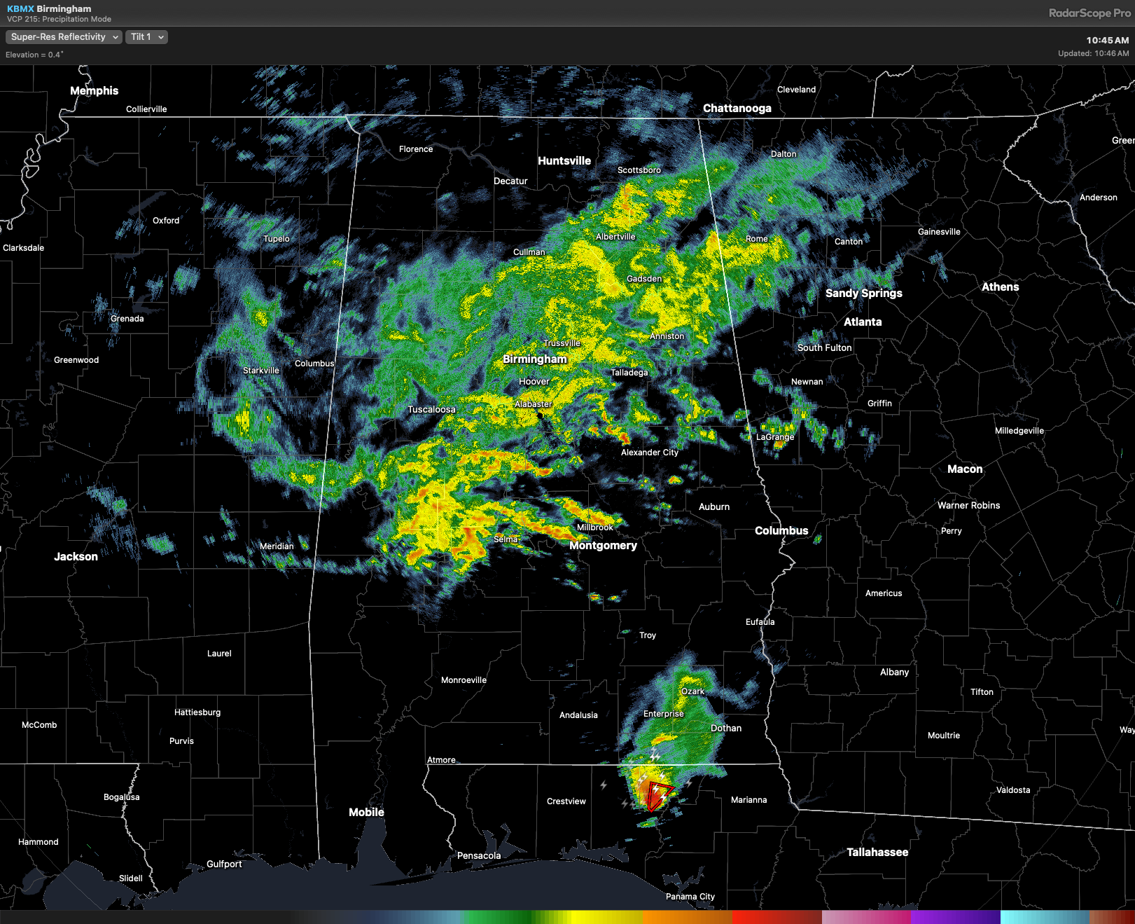
Radar as of 10:45AM this morning.
A WET SATURDAY FOR NORTH ALABAMA: A dreary Saturday is shaping up for North Alabama as low pressure along the Gulf Coast tugs a cold front northward into the Tennessee Valley. Rain is already in the area, and it’ll steadily push northward through the day, keeping widespread showers in the region. Expect rain chances to rise to 70–90% by late morning through the afternoon. Thanks to thick cloud cover and persistent rain, temperatures won’t move much. Many spots will only top out in the mid 60s… 10 to 15 degrees cooler than average for May. Some areas may only see a 2–3 degree change all day.
Rain coverage should taper off some after sunset Saturday night as the upper-level low shifts slightly west and daytime heating fades. Even so, clouds will hang tough, and a tight pressure gradient will keep breezy conditions around with winds 5–10 mph and gusts up to 20 mph. Overnight lows will be mild due to the cloud cover, settling in the 55–60° range.
RAIN & BREEZY FOR CENTRAL ALABAMA: We’ll see periods of showers and gusty winds throughout the day, however, we’ll see a break in the rain as a dry slot pushes into the south. But don’t get too comfortable — a third wave of moisture is developing to the south and will likely move in during the early evening, so we’ll need to keep an eye on the radar for any changes as the day progresses.
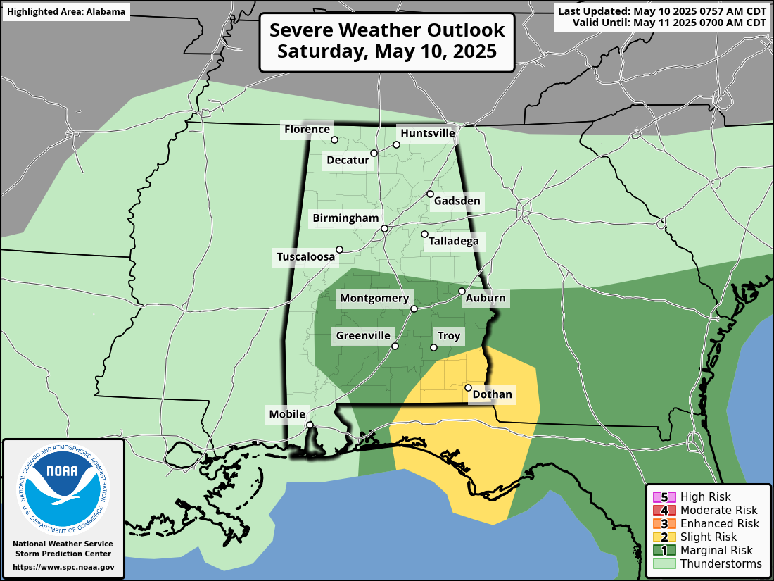
STORMY SETUP IN SOUTH ALABAMA TODAY: Low pressure over southern Alabama and a front draped across the region are setting the stage for an active weather day. As the atmosphere destabilizes with daytime heating, storms will become more numerous and could turn severe this afternoon.
A Slight Risk covers Houston, Geneva, and Henry counties, and portions of Dale and Covington counties. A Marginal Risk covers Coffee, Pike, Crenshaw, Butler, Lowndes, Montgomery, Macon, Bullock, and Barbour counties, and portions of Dale, Russell, Lee, and Elmore counties.
A few storms may rotate, and we can’t rule out a brief, weak tornado or two—especially in far southeast Alabama. Moist air and wind shear are already in place, and with more heating, storm coverage and intensity will increase. Most of the activity will remain southeast of a Montgomery–Eufaula line, but if the air mass continues to recover, the risk may spread a bit farther north into south-central and eastern Alabama later in the day. We’ll be watching this closely through the afternoon.
Category: Alabama's Weather, ALL POSTS, Severe Weather, Social Media
About the Author (Author Profile)
Scott Martin is an operational meteorologist, professional graphic artist, musician, husband, and father. Not only is Scott a member of the National Weather Association, but he is also the Central Alabama Chapter of the NWA president. Scott is also the co-founder of Racecast Weather, which provides forecasts for many racing series across the USA. He also supplies forecasts for the BassMaster Elite Series events including the BassMaster Classic.Subscribe
If you enjoyed this article, subscribe to receive more just like it.


