Storms Moving Northeast Across South Alabama
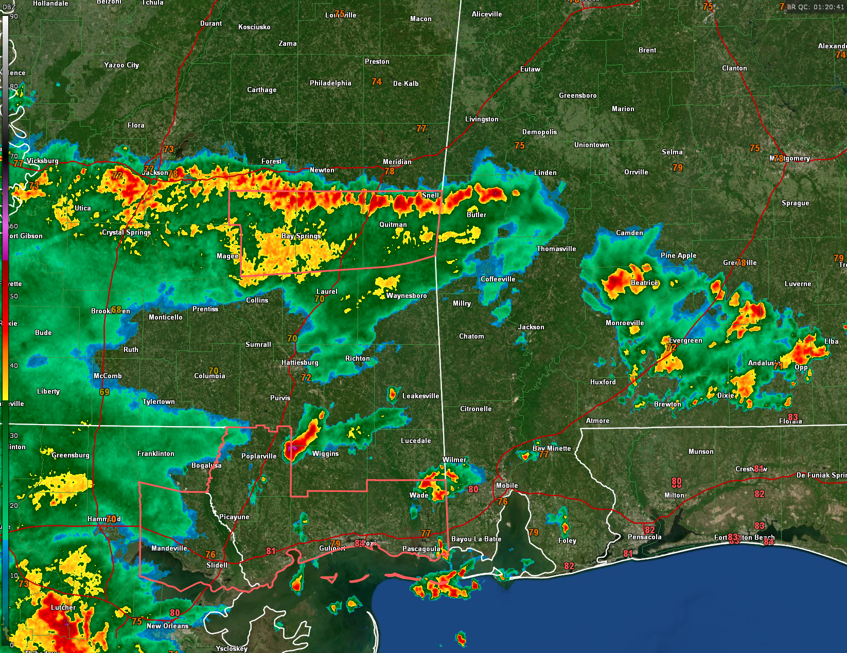
The line of storms currently moving northward across eastern Louisiana, southern Mississippi, and southwestern Alabama was triggered by a potent shortwave disturbance embedded in southwesterly mid-level flow, originating from southeast Texas and the northwest Gulf of Mexico. This disturbance, also known as a 500mb shortwave, enhanced lift and destabilized the atmosphere over the Deep South, helping storms to initiate earlier today across coastal Louisiana and Mississippi.
Additionally, abundant low-level moisture, modest instability with MLCAPE values around 3000 J/kg, and strong daytime heating fueled the initial updrafts. Even though low-level shear and surface flow were somewhat weak—limiting the potential for organized severe wind—the presence of outflow boundaries from earlier convection also played a role in organizing the storms into a loosely structured line, or QLCS (quasi-linear convective system).
This system is now lifting slowly northeast into Alabama. As of 7:50 PM CDT, the leading edge of the storms was located near Camden and approaching Greenville, slowly lifting northeast. While it is expected to gradually weaken overnight due to the loss of surface heating and a stabilizing air mass, it may still bring gusty winds, brief downpours, and rumbles of thunder as it approaches the I-65 corridor and eventually reaches the Birmingham metro between 2 and 3 AM CDT.
Category: Alabama's Weather, ALL POSTS, Severe Weather, Social Media
About the Author (Author Profile)
Bill Murray is the President of The Weather Factory. He is the site's official weather historian and a weekend forecaster. He also anchors the site's severe weather coverage. Bill Murray is the proud holder of National Weather Association Digital Seal #0001 @wxhistorianSubscribe
If you enjoyed this article, subscribe to receive more just like it.


