Severe Thunderstorm Warning for Southwestern Tuscaloosa, Northeastern Greene, Hale, and West Central Bibb Counties Until 5:15 PM CDT
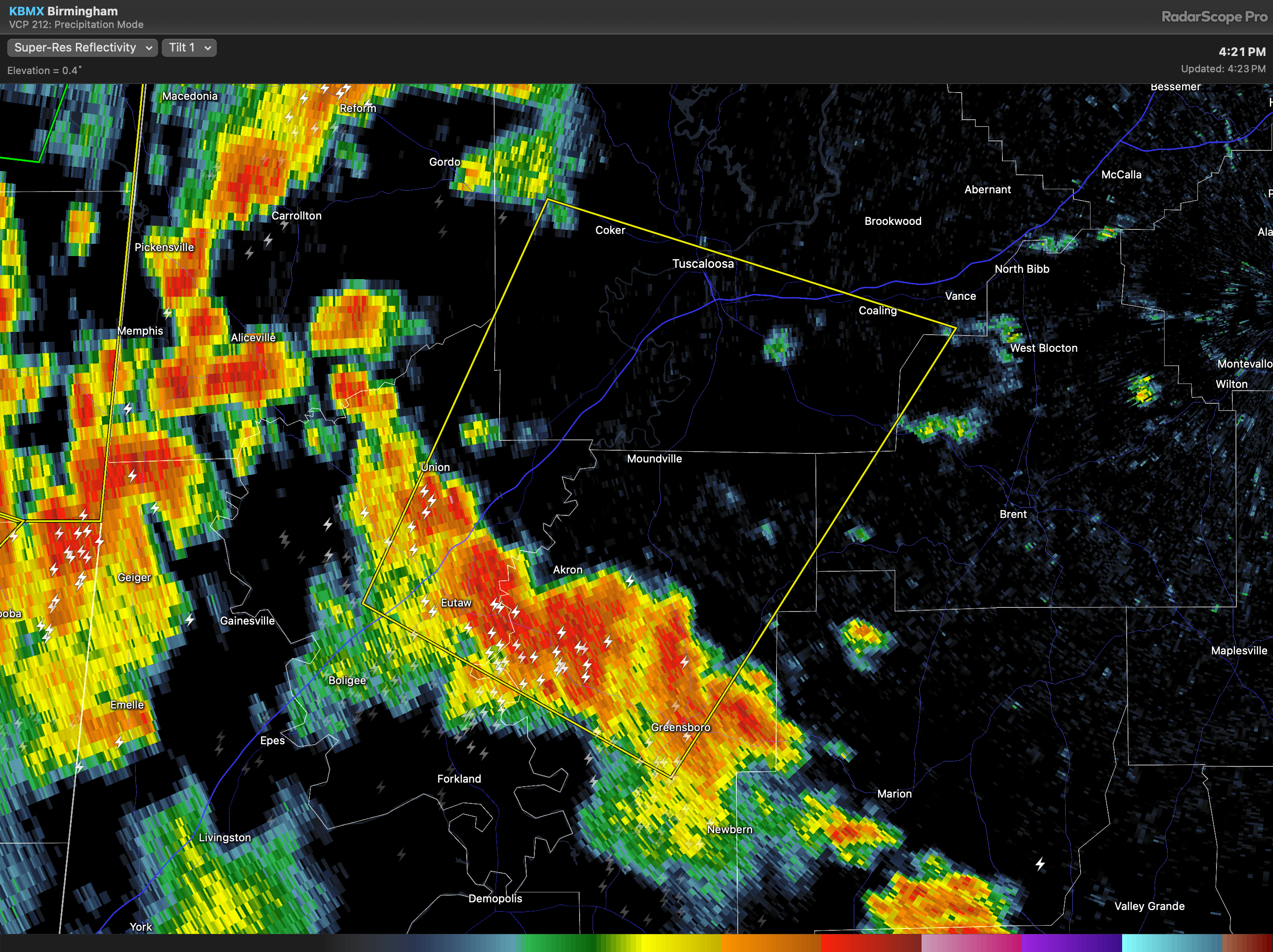
The National Weather Service in Birmingham has issued a Severe Thunderstorm Warning for southwestern Tuscaloosa County in west central Alabama, northeastern Greene County in west central Alabama, Hale County in west central Alabama, and west central Bibb County in central Alabama, effective until 5:15 PM CDT.
At 4:22 PM CDT, a severe thunderstorm was located over Akron, approximately 10 miles east of Eutaw, and was moving north at 25 miles per hour. The storm is capable of producing wind gusts up to 60 miles per hour, as indicated by radar. These winds may cause damage to roofs, siding, and trees.
Areas likely to be impacted include Tuscaloosa, Northport, Eutaw, Greensboro, Moundville, Coaling, Vance, Coker, Akron, Union, McFarland Mall, Tuscaloosa Amphitheater, Tuscaloosa Regional Airport, Low Gap, Sawyerville, Knoxville, Shelton State Community College, Bryant Denny Stadium, Wedgeworth, and University Mall. Residents in the warned area should move to an interior room on the lowest floor of a sturdy building for protection.
Category: Alabama's Weather, ALL POSTS, Severe Weather
About the Author (Author Profile)
Scott Martin is an operational meteorologist, professional graphic artist, musician, husband, and father. Not only is Scott a member of the National Weather Association, but he is also the Central Alabama Chapter of the NWA president. Scott is also the co-founder of Racecast Weather, which provides forecasts for many racing series across the USA. He also supplies forecasts for the BassMaster Elite Series events including the BassMaster Classic.Subscribe
If you enjoyed this article, subscribe to receive more just like it.


