Tropical Depression Chantal: Final Update
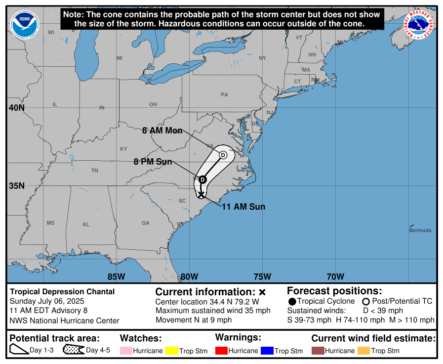
Chantal has weakened into a tropical depression as it moves further inland across the Carolinas. As of late Sunday morning, the center of circulation was located near the North Carolina/South Carolina border, with top sustained winds now down to 35 mph. The system will continue to weaken today and is expected to lose its tropical characteristics by Monday as it transitions into a trough of low pressure. However, the moisture left behind will still bring impacts into early next week.
The main concern going forward will be heavy rainfall across parts of eastern and central North Carolina through Monday, which could lead to flash flooding—especially in urban areas where runoff is more likely. Some isolated to scattered flooding could occur where heavier bands of rain set up.
Although winds have diminished, dangerous surf and rip currents will continue along much of the Southeast and Mid-Atlantic coasts from northeast Florida to the Outer Banks through at least Monday. If you’re heading to the beach, stay out of the water unless local officials say it’s safe.
This will be the final update from the National Hurricane Center on Chantal.
About the Author (Author Profile)
Scott Martin is an operational meteorologist, professional graphic artist, musician, husband, and father. Not only is Scott a member of the National Weather Association, but he is also the Central Alabama Chapter of the NWA president. Scott is also the co-founder of Racecast Weather, which provides forecasts for many racing series across the USA. He also supplies forecasts for the BassMaster Elite Series events including the BassMaster Classic.Subscribe
If you enjoyed this article, subscribe to receive more just like it.


