Tornadoes, flooding
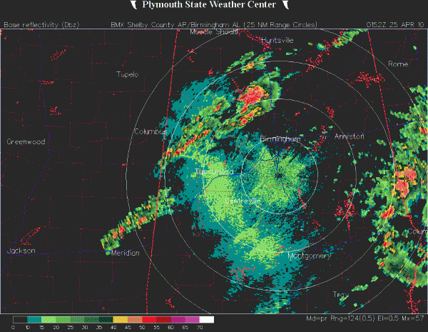
As the low-level jet continues to pull north, away from Alabama, the wind shear is slowly going down. Also, with nightfall, instability is not increasing overall with the weather system. So, it is not surprising that the aerial coverage of tornado warnings has gone down over the past 5 hours. However, CAPE is still 1,000 J/kg, and helicity is >200 m2/s2 over north Alabama, so tornadoes are still possible. The storms have slowed down, so the threat for BHM may not be over until after midnight. Don’t forget to leave the NOAA Weather Radio on standby when you go to bed. There are still warnings in effect in parts of Walker, Cullman, and Blount Counties, so if you are there, or downstream from these storms in northern Blount or Marshall counties, go to a safe place now.
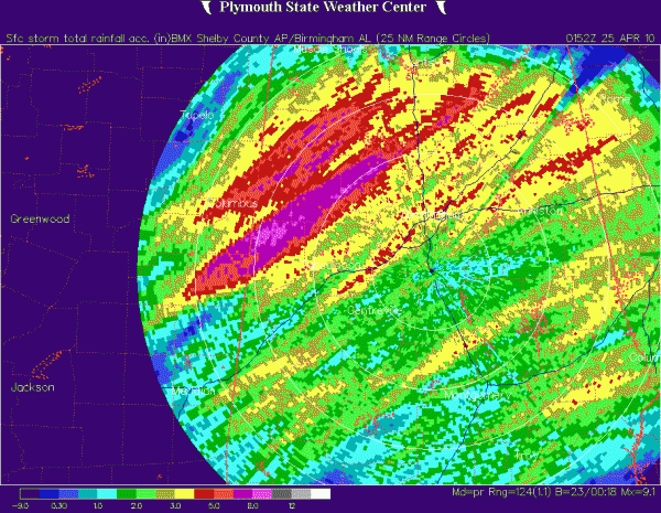
A concern is also flooding and flash flooding, especially at night. 3.41″ of rain has fallen at BHM airport today, and radar indicates that some places have received over 6″, especially along the line where storms have been training this evening, in Fayette, Walker, and Tuscaloosa counties. With the slow eastward movement of the storms, flash flooding will be a threat overnight. Don’t drive into water-covered roadways…you may think you can make it, but the road can wash out underneath and your car can be swept away. River flooding may start overnight and tomorrow, with large areas receiving 3-5″ of rain. The Mulberry Fork of the Warrior River at Garden City has risen 5 feet, and the flow is 5220 cubic feet per second, just shy of 5930 fps record in 1973, and about 12 times the median flow (normal) of 402. So, the Cahaba, Black Warrior, and Tombigbee Rivers may have some flooding.
Category: Uncategorized


