Tropical storm Bonnie, heat continues
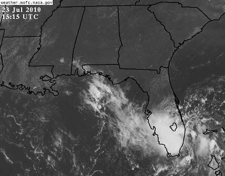
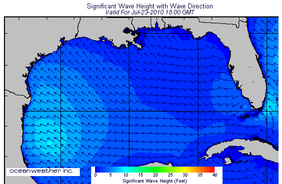
Tropical storm Bonnie is near Miami, Florida this morning, however it is not causing any significant weather due to its relatively low winds, especially over land. The highest gust I’ve seen is 52 mph, at an automated station off the Florida coast. There are some 10 foot waves near the coast off Dade and Palm Beach Counties.
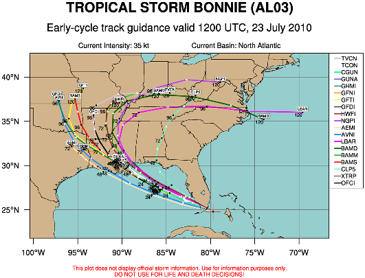
Bonnie will now move across Florida and into the Gulf of Mexico. However, despite warm surf temperatures, the Gulf is not favorable for this storm to become a hurricane. There is a large amount of wind shear due to an upper level low in the southern Gulf and the strong heat-related ridge over Mississippi, Alabama, and Georgia. Winds aloft in the Gulf are as high as 60 mph…so the thunderstorms around Bonnie will tend to get sheared apart, and it will not allow the heat generated by the storms and ocean water transport to be centered near Bonnie. Most models keep Bonnie’s winds below 50 mph all the way across the Gulf, and some weaken it to a tropical depression. However, given its btrack toward the oil spill area and New Orleans, and the risk that the shear could weaken and the models could be wrong, NHC has issued a Tropical Storm Warning from Morgan City, Louisiana to Destin, Florida.
If I had a trip planned to the beach in Alabama, or Florida this weekend, I would go. You might see some pretty big waves, and it might rain some, but you’ll get the thrill of a tropical storm passing by without any significant risk of danger. There could be a storm surge of 3 to 5 feet, mainly west of Mobile, but overall this storm’s biggest impact will probably be heavy rain along the coast and into MS/LA/AR, and moving the remaining oil west toward Louisiana. ** Things could change **, so if you’re going to the beach keep a close eye on the weather and a full tank of gas in the vehicle.
Unfortunately for us here in north and central Alabama, Bonnie may not bring us any widespread rain, but it will bring scattered thunderstorms due to high moisture content, and that could bring us some cooling by Monday and Tuesday. But, this weekend, expect highs in the upper 90s and heat index 100-110 in the middle of the day, and take extra precautions. Drink plenty of water, don’t stay outside for too long at a time, and check on the elderly to make sure they have plenty of air conditioning and fluids to drink. If someone’s air goes out this weekend, it might be wise to spend some time in the local library, grocery store, or something, to cool off. Ceiling fans make it feel cooler and they are a great idea, but remember they are evaporating water from your skin and you have to drink more water.
Category: Uncategorized


