Neat radar and satellite image
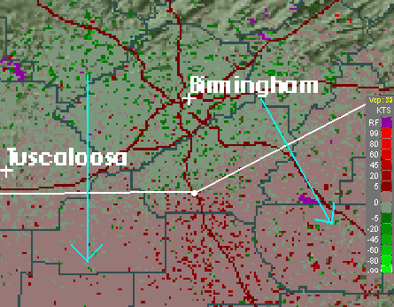
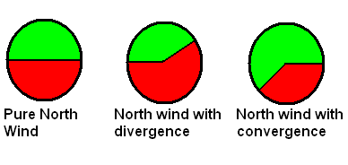
This is the Doppler velocity image from the NWS Birmingham radar (located at the white dot). It is showing something interesting. The winds over Alabama today are generally out of the north. Since green indicates winds toward the radar and red indicates winds away from the radar, a north wind would generally show up with the north half of the circle around the radar being green (inbound), and the south half being red (outbound), as shown below on the left radar schematic.
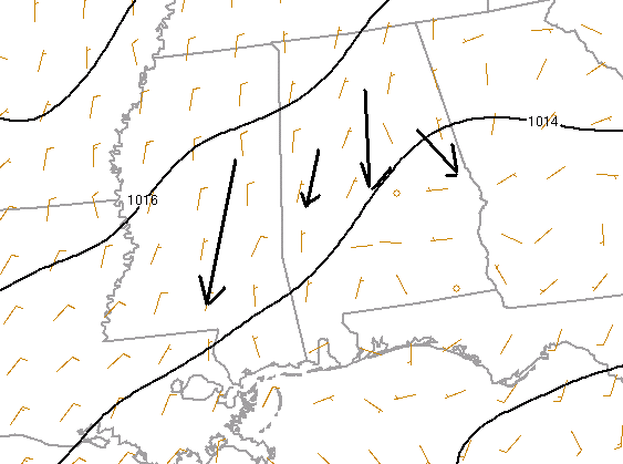
However, when there is divergence, or spreading out of the wind at low levels, you see more outbound than inbound (like in the middle picture). If there is convergence, there is more inbound. Clearly, today’s image matches the one in the middle, showing divergence. You can see this low-level divergence on the surface wind chart.
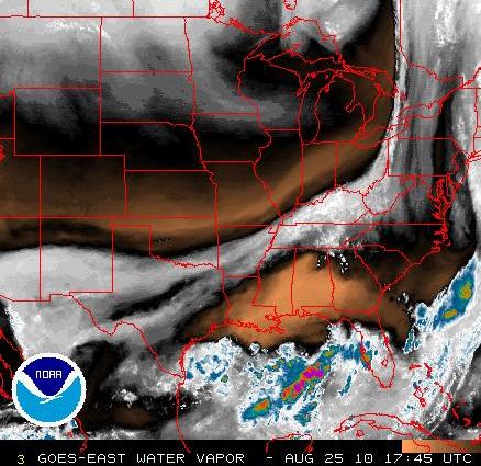
At upper levels, the winds are converging. So, since air is piling in at upper levels and spreading out at lower levels, there has to be downward motion. This brings down dry air from aloft, part of the reason for the low humidity. But, the dry air is very deep, and it is even drier here and over the Gulf Coast than it is in Canada! The satellite image below is water vapor imagery, that senses the radiation from a “channel” or frequency in the atmosphere that mainly emits from the water vapor at mid-levels.
This satellite picture shows very dry air over the SE US. Cool.
Category: Met 101/Weather History


