Checking in on the Tropics
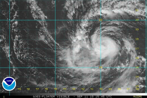
Tropical Storm Igor will become a hurricane later today.
It is about 1500 miles east of the island of St. Martin in the northern Leewards this afternoon. It is moving west northwest at 20 mph, being steered by a large high pressure system over the Atlantic.
The storm continues to get slowly more organized and it is expected to become a large and intense hurricane over the next three days. It should become a major hurricane Monday or Tuesday.
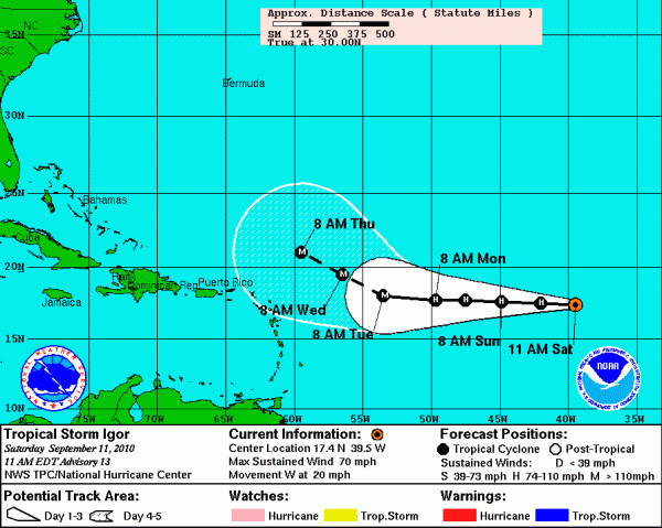
The consensus is that it will pass northeast of the islands of the Caribbean at midweek, passing about 300 miles north of the northern Leewards late Wednesday or Thursday. Then things are uncertain. The GFS steers it out to sea, but that is not set in stone.
Here is the five day track from the NHC:
JULIA?
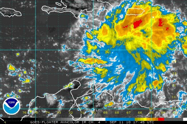
Disturbed weather associated with a tropical wave over the eastern Caribbean south of Puerto Rico continues to be impressive and a tropical depression could form there in the next 24 hours. The NHC puts that probability at 60%.
The models are all over the board on this one, known as Invest 92L. Some develop it into a hurricane, evens an intense one. Some don’t develop it at all. Look for it to reach Jamaica Tuesday and the Yucatan by late in the week. There should be a high over the northern Gulf by then, so a northward track in the Gulf looks unlikely. It could end up over Hispanioia, which would keep it from amounting to much, but it would bring life threatening rains and mudslides to Haiti and the DOminican Republic. They don’t need that in still earthquake ravaged Haiti.
Category: Uncategorized


