Evening Severe Weather Update
Quite a contrast is developing across Alabama this evening… our SKYCAM site in Gadsden is reporting 46 degrees with a chilly east wind and a cold rain falling. But, on the other side of the state, Demopolis is at 62 degrees with a dewpoint of 60. That is the air that will move northeast during the night and set the stage for possible severe weather.
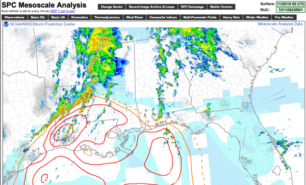
Below is the current STP analysis (significant tornado parameter)…

Values are maximized over the southern parishes of Louisiana, in the true warm sector of the developing storm.
It will be an interesting night to see if we can get dewpoints in the low to mid 60s up into Alabama. Sure seems like the greatest risk of severe weather in the midnight to 6:00 a.m. time frame will be west of U.S. 82, or west of a line from Gordo to Tuscaloosa to Montgomery.
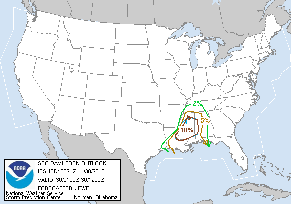
We note that in the new convective outlook for tonight, SPC has moved the 10 percent tornado probability zone over into West Alabama…

We will be waiting and watching… and don’t forget to join us for WeatherBrains at 8:30. We will have the uStream viewer here on the blog shortly before show time…
Category: Severe Weather


