Weekend Weather Roller Coaster
Peeking at the new 00Z guidance tonight… seems like the forecast is in pretty good shape. Rain amounts of around 1/2 inch tomorrow afternoon and tomorrow night, followed by the Arctic Express and frigid air Sunday.
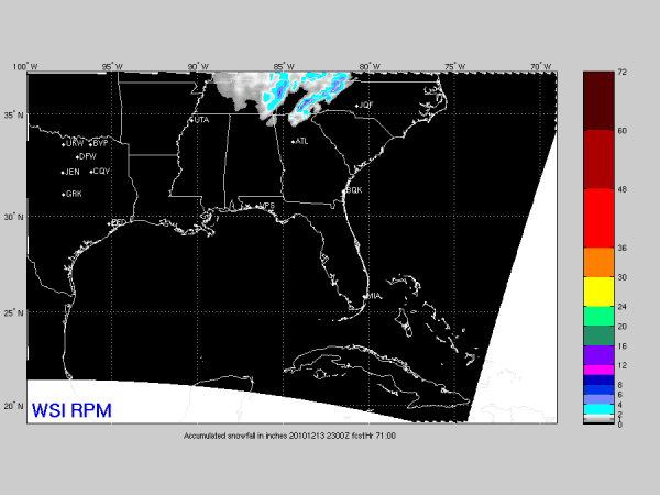
Here is the 00Z RPM snow accumulation chart for Sunday…
Matches our idea that the best chance of getting the ground white Sunday morning will be across high terrain of Northeast Alabama’s Jackson, DeKalb, Marshall, and Cherokee Counties.
Flurries are likely for all of North-Central Alabama during the day Sunday as the cold air rushes south. We will drop to near freezing and stay there all day, with northwest winds of 15-30 mph.
Category: Alabama's Weather


