

A Look at our Line of Storms
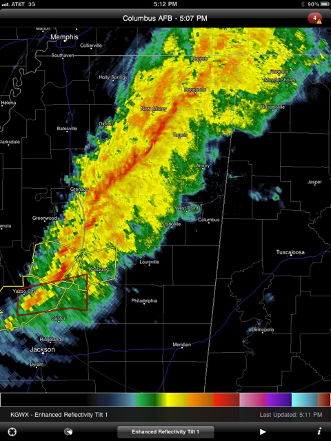
As expected, the thunderstorms over Mississippi has congealed into a squall line. It is pushing quickly east at 35 mph.
That storm southeast of Yazoo City is tornado warned. Strong rotation was observed on radar as it moved near Yazoo City a little earlier.
Severe. Thunderstorm warnings are in effect ahead of the line over parts of South Central Mississippi.
The line will reach Northwest Alabama’s Franklin and Marion Counties around 6:30, Lamar and Pickens Counties between 7:30 and 8 and Sumter County between 8:30 and 9.
The severe weather threat is higher in Mississippi and will decrease as the line moves into Alabama but the threat for some damaging winds will exist ahead of the line as it moves into our state.
The rapid change to colder and very windy conditions will highlight our weather late tonight and Sunday into Tuesday along with the chance of snow shorts tomorrow over roughly the northern half of the state. Accumulations are expected to be up to an inch over The Tennessee Valley counties with some locally higher amounts possible over the higher elevations of Northeast Alabama.
Category: Uncategorized
About the Author (Author Profile)
Bill Murray is the President of The Weather Factory. He is the site's official weather historian and a weekend forecaster. He also anchors the site's severe weather coverage. Bill Murray is the proud holder of National Weather Association Digital Seal #0001 @wxhistorianSubscribe
If you enjoyed this article, subscribe to receive more just like it.


