Late look
…SNOW STORM IN NORTH AND CENTRAL ALABAMA…POSSIBLE ICE STORM IN MONTGOMERY AND AUBURN…
With all 4 models in, about the same regarding north and central Alabama…4″ in most places, up to 8″ in isolated locations, especially in higher terrain of east Alabama. This one will be a school-closer.
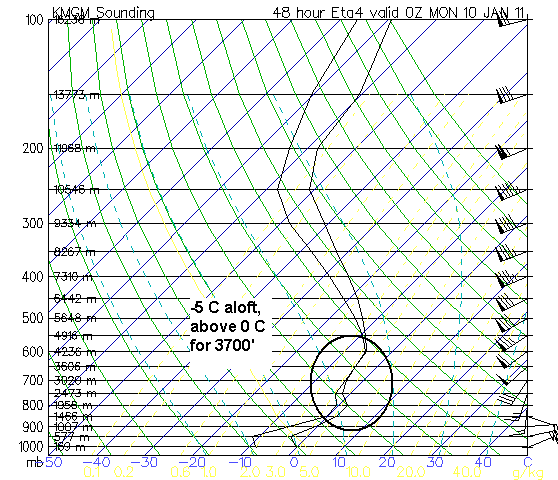
I am becoming increasingly concerned about the possibility of a damaging ice storm in parts of southeast Alabama (Montgomery, Auburn, maybe Troy). The model sounding shows the temperature profile in Montgomery at 6 pm Sunday. Notice the layer of saturated air (the temp and dewpoint lines are together) aloft, with a temp of -5 C. This may not be cold enough for a lot of snow to form, but instead rain, that will then fall and freeze on contact. Several people have asked about going to Auburn on Monday to watch the football game (I think they are showing it in the arena)…I would leave during the day on Sunday and prepare to stay until Tuesday afternoon. And, make sure they have a generator in the arena to run the heat and the big screen TV.
Category: Winter Weather


