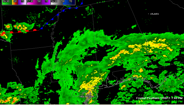
Showers Slow to Move North
An upper level trough is moving eastward across Louisiana tonight. Showers spread into West Alabama this afternoon, but they quickly fell apart.
Meanwhile, showers are widespread over eastern Louisiana, the southern half of Mississippi and southern Alabama.
So far, the showers have been reluctant to move into Central Alabama. We will have to see if that trend continues overnight. We still expect the moderate rain to reach the I-20 corridor after midnight.
This system will push east and allow for some clearing tomorrow. Temperatures will be mild, with hihs in the 60s, and there could be a few places that reach 70F tomorrow afternoon.
Rain and storms will be widespread Tuesday afternoon and Tuesday night ahead of a strong cold front. We will go from upper 60s Tuesday to near freezing by Wednesday morning. Rainfall could be heavy and should average one to two inches. Severe weather does not look like a big threat at this time.
We will have to watch developments in the Thursday and Friday time frame as the last couple of model runs have been promoting the idea of a low over northern Gulf. This could bring some light snow to Northwest Alabama late Friday and a few flurries into Saturday morning as far south as the I-20 corridor. I doubt accumulation will be a problem, but this is voodoo country, so we will be monitoring the situation.
Category: Alabama's Weather


