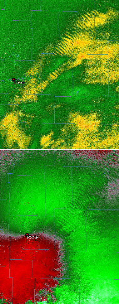
Gravity waves, Alabama weather update
…TORNADO WATCH SW AL…SEE DETAILS BELOW…
Check out the gravity waves on the Springfield, MO radar this morning! The areas of convergence between each wave in the velocity field (lower) are causing enhanced precipitation, showing up in reflectivity (upper). Thanks to Todd Murphy (UAH) for these pictures.
So, what about Alabama? Rain is moving in, and a line of storms is located over central and southern Mississippi, moving this way. SPC has Alabama under a slight risk for severe storms for late afternoon and tonight. It seems unlikely that any tornadoes, or even widespread severe thunderstorms, will occur north of Clanton, or even Demopolis. But, in the northern half of the state, the gradient winds (not thunderstorms, normal wind) will be near 70 mph at 5,000 ft., and any thunderstorm (or even rain shower) can mix some of this wind down to the ground, so we will likely have some trees and power lines go down this evening simply due to that. Overall, the threat of a big severe weather outbreak is minimal.
Category: Alabama's Weather


