Wet and Windy
It is wet and windy across much of Alabama tonight.
The only severe thunderstorm warnings now are for parts of Mobile and Baldwin Counties. A tornado watch remains in effect as far north as Choctaw, Clarke and Wilcox Counties in Southwest Alabama.
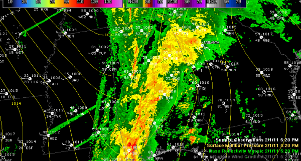
Here is a messy map that tells the story at this hour. A fairly decent low pressure system was moving rapidly northeast out of western Tennessee. A surface trough extends into West Alabama The wind has shifted at Tuscaloosa in the past few minutes to the southwest. The rain mostly ends with the arrival of the trough axis.
Radar shows some enhanced reflectivity from west of Cullman down through western Jefferson County to east of the City of Tuscaloosa. There could be some very strong gusty winds, perhaps 40-50 mph as this segment passes.
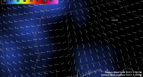
As you can see, the winds die off a bit between the trough and the front, but will become quite strong later tonight after the front arrives. The NWS Memphis has issued a high wind warning for their northern Mississippi counties.
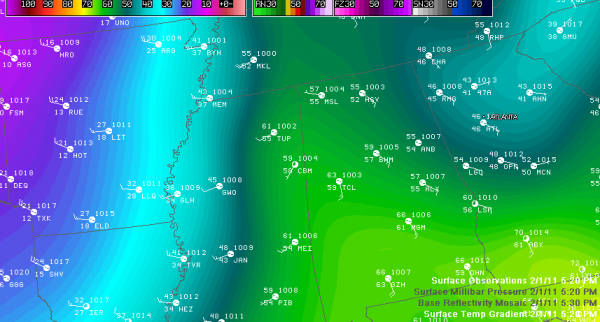
The front extends from near Memphis to Meridian at this hour. Temperatures will fall sharply behind the front. This map shows that very clearly.
It is 63F at Tuscaloosa, 45F at Greenwood MS, 32F at Monticello, AR, 21F at Hot Springs and 16F at Springdale AR. That’s how fast the temperature falls. It will take only 4-5 hours for temperatures to fall to freezing once the front arrives, so we will have to watch for patches of black ice that form from residual rainfall left on area roads tonight. Be careful if you will be driving later.
Category: Alabama's Weather


