Airmass Tug of War
An interesting situation across Alabama on this Sunday. Remember looking at those low dew points over the Tennessee Valley? They signified some really dry air behind a cold front that drifted down into the state Friday night.
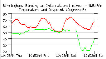
 Well, that dry air pushed further south during the night last night, crashing dew points into the lower 20s and even lower in spots over the northeast part of the state. Check out this graph of temperature and dewpoint at BHM. The dew point line is shown in green.
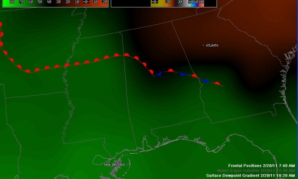
Look at this graphic of the dew point gradient and the placement of the front. The blacks and reds indicate dew points in the 20s and 30s.
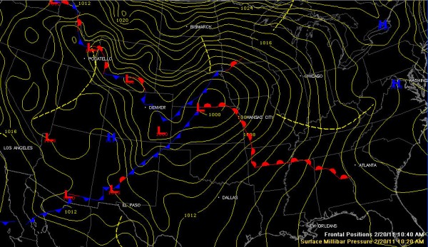
Now the situation is already changing, as increasing southeasterly winds blowing between high pressure off the North Carolina coast and a 1000 millibar low over southern Nebraska. Take a look at the national surface map.
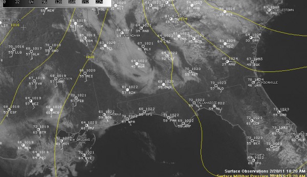
Clouds are thickening across the state as the warmer, more moist air from the southeast rides up and over this wedge of dry air extending down I-59 to Birmingham.
Here is a visible satellite with 10 a.m. surface observations overlain. The yellow lines are ispbars, or lines of equal pressure.
The clouds are keeping things a little cooler, with the 67F reading at Birmingham 5 degrees behind same time yesterday. This will translate into highs in the lower, instead of middle and upper 70s like yesterday. Still not bad for February.
Regional radars are quiet. We should stay dry across Central Alabama through Monday morning, with a slight chance of a shower during the day. A cold front will push a weakening band of showers into and across the state tomorrow night. Rainfall amounts will be light, generally around one tenth of an inch.
Category: Alabama's Weather


