Severe Weather Kind Of Day
An all new edition of the ABC 33/40 Weather Xtreme video is available in the player on the right sidebar of the blog. You can subscribe to the Weather Xtreme video on iTunes by clicking here.
THIS MORNING: Things are very balmy across Alabama this morning, but rather quiet at 5:00 a.m. Temperatures are in the 65-70 degree range, with dewpoints well into the 60s. Light rain is falling in spots, mainly over the eastern half of the state.
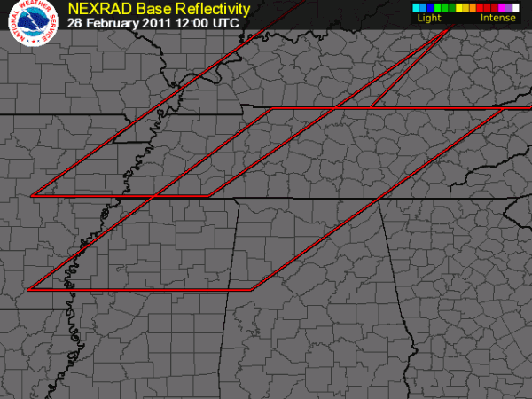
TO THE WEST: SPC is in the process of issuing a tornado watch for much of North Mississippi and parts of Northwest Alabama. No doubt this will be a rather long day of watches and warnings… be sure and watch the Weather Xtreme video for all of the graphics and other details that go along with this discussion.
Here is a quick look at the new tornado watch, in effect until 1:00 p.m. CST…
THE SETUP: No need to look much at computer model data since the system is knocking on the door and we can just look at observed weather. Low level shear values (0-1 km storm relative helicity) are pretty impressive just northwest of here, with values in the 500-600 m2/s2 range. Certainly sufficient for rotating updrafts. And, with surface based CAPE values already around 1,000 j/kg at 5:00 a.m…. you know those values will be higher at midday as the daytime heating process kicks in.
The limiting issue right now is a capping inversion, or nose of warm air several thousand feet off the ground. This is preventing convection from forming south of U.S. 82 in Mississippi, and keeping much of Alabama free of serious thunderstorms. But, the cap should weaken and break within the next few hours thanks to cold air advection aloft and the warmer surface temperatures that are coming.
BOTTOM LINE: All modes of severe weather will be possible today across the northern half of Alabama, including the potential for isolated tornadoes. SPC maintains a moderate risk of severe weather today for areas along and north of U.S. 278, with the standard slight risk all the way down to Mobile. Everybody needs to be near a good source of severe weather watches and warnings today… and you might take a moment to review your severe weather plan this morning, especially in schools and businesses. The primary risk of severe weather will come from 8:00 a.m. until 4:00 p.m… everything will be well to the south by 5:00.
REMEMBER: Outdoor warning sirens are just that… for people that are outdoors. And, they are not very good at that. A reminder you can get warnings sent to your cell phone or land line phone via ABC 33/40 WeatherCall… you can sign up here.
REST OF THE WEEK: Cooler and drier air arrives tonight with a clearing sky; most places will be in the mid to upper 30s early tomorrow. Look for sunny pleasant days and clear cool nights tomorrow through Thursday… some of the coldest valleys across North Alabama might touch freezing briefly early Wednesday, but most places will be in the 35-42 degree range. Moisture begins to return Friday with some risk of scattered showers.
ANOTHER SEVERE WEATHER THREAT? The 06Z GFS shows another fairly robust system impacting Alabama on Saturday with potential for strong to severe thunderstorms… we will fine tune that risk once we get today’s system east of here. Sunday look dry and cooler with a high in the 50s along with a good supply of sunshine.
WEATHER BRAINS: Don’t forget you can listen to our weekly 30 minute netcast anytime on the web, or on iTunes. This is the show all about weather featuring many familiar voices, including our meteorologists here at ABC 33/40. We will record this week’s episode tonight at 8:30 CST… Jeff Rosenfeld, Editor of BAMS (Bulletin of the American Meteorological Society) will be our guest.
FOLLOW ALONG: Here are our weather team Twitter accounts….
| James Spann | Jason Simpson | Ashley Brand |
| J. B. Elliott | Bill Murray | Brian Peters |
| Dr. Tim Coleman | WeatherBrains Podcast | E-Warn (AL wx watches/warnings) |
Stay with the blog for running updates on the Alabama severe weather situation today…
Category: Alabama's Weather


