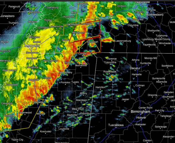
Early Afternoon Look…
The line of severe storms is moving very quickly… it will be into Northwest Alabama shortly…
A few tornado warnings have been issued by the NWS Memphis for southern Tennessee for the possibility of spin-ups along the line, but damaging straight line wind remains the biggest threat.
The air is moderately unstable across Alabama, with surface based CAPE values in the 500-1000 j/kg range.
We will need to amend the timeline based on the fast movement of the line…
NORTHWEST ALABAMA (Florence, Hamilton, Russellville, Haleyville, Fayette, Vernon etc): 1-2 p.m.
WEST-CENTRAL ALABAMA (Tuscaloosa, Reform, Eutaw) 4-5 p.m.
BIRMINGHAM/GADSDEN METRO (Jefferson, Shelby, Walker, St. Clair Etowah counties) 5-6 p.m.
ANNISTON METRO (Calhoun and surrounding counties) 6-7 p.m.
Stay tuned for more updates…
Category: Severe Weather


