Severe Weather Potential
Time to peg the weather geek meter… but the bottom line remains that the primary severe weather will be from strong straight line winds along a squall line that will pass through Alabama tonight. The main severe weather threat will be begin over Northwest Alabama around 3-5 p.m… reaching Tuscaloosa/Birmingham/Gadsden around 6-8 p.m… and then to Anniston around 9 p.m. or so.
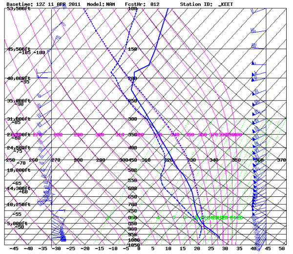
Below is a forecast sounding for the Shelby County Airport, valid at 7:00 p.m. this evening…
Note the wind profile on the right is somewhat unidirectional… similar to the event last Monday night when there were no tornadoes. You really want to see those surface winds backed to the southeast for a big tornado threat.
But, keep in mind, there was considerable tree and power line damage as the line passed through, so you will need to really pay attention to the severe thunderstorm warnings that are issued. And, of course, you always have to expect the unexpected, so a tornado warning is not out of the question.
A few selected severe weather parameters forecast for 7:00 p.m…
Surface based CAPE 1586 j/kg (moderately unstable for April)
Lifted index -4.3
EHI (energy helicity index) 2.7
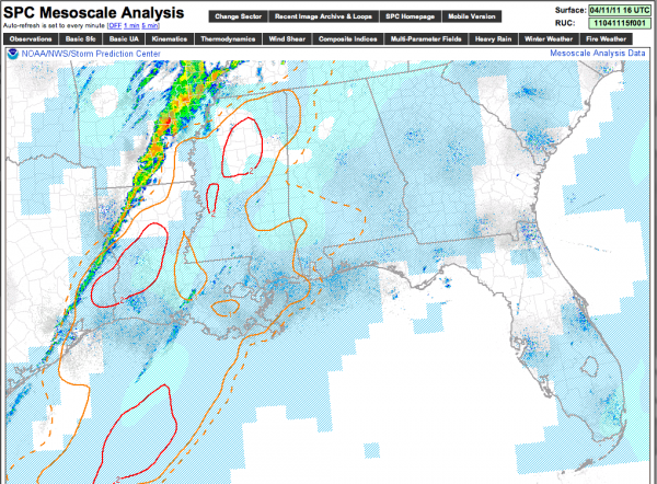
Seems like the best risk of any significant tornado activity will be west of Alabama this afternoon; see the current (as of 11:30 a.m. CDT) significant tornado parameter values, which are highest over Mississippi and Louisiana…
Stay tuned for updates through the afternoon as the storm threat gets closer.
Category: Severe Weather


