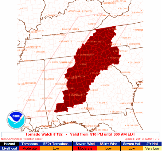
New Tornado Watch until 2 AM (CDT)
The Storm Prediction Center has issued a new TORNADO WATCH until 2 AM CDT for the following counties in Alabama:
. ALABAMA COUNTIES INCLUDED ARE
AUTAUGA- BARBOUR- BULLOCK
BUTLER CALHOUN CHAMBERS
CHEROKEE CLAY CLEBURNE
CONECUH COOSA CRENSHAW
ELMORE ETOWAH LEE
LOWNDES MACON MONROE
MONTGOMERY PIKE RANDOLPH
RUSSELL ST. CLAIR TALLADEGA
TALLAPOOSA
This line of thunderstorms will progress on through east Alabama by 10 PM CDT, so the severe weather threat will end in Birmingham as soon as the line passes. In the Anniston/Gadsden area, we still have about 2 hours before the storms pass through. Expect winds to increase ahead of the storms, and then wind could gust above 60 MPH as the actual storms pass through. The damaging wind threat is the main deal here, but isolated tornadoes are still possible along the line.
It may be as late as 11 PM or after before storms completely clear the Montgomery area, and this could roll on through the wee hours of Tuesday morning in far southeast Alabama and over Georgia.
-Follow me on Twitter: @simpson3340
Category: Severe Weather


