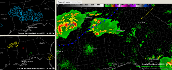
The Alabama Weather Situation at 4:15 p.m.
Strong thunderstorms continue over Northeast Mississippi in an area of maximized instability.
The storms are not making the transition over into Alabama very well, which is good news. The airmass over Northwest Alabama is very stable from early morning storms.
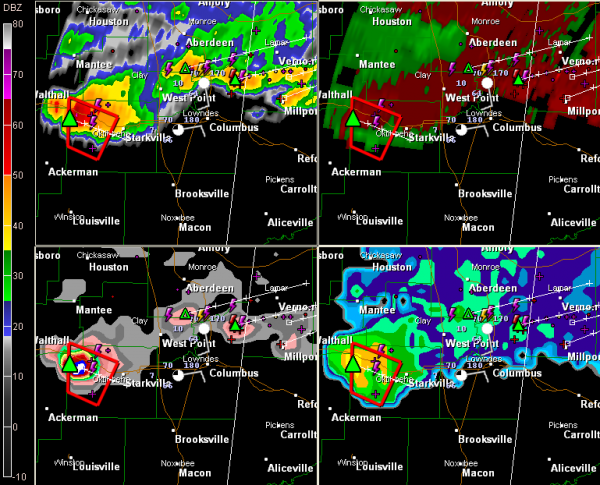
A tornado warning is in effect for the area just west of Starkville MS. A severe thunderstorm warning was actually in effect for the town and campus, but it was allowed to expire at 4:15. A new warning was just issued for Oktibbeha County. Rotating clouds and 1/2 inch hail was reported 8 miles west of Starkville at 4:28 p.m.
This dangerous storm is pushing southeast at about 20 mph, not the 55 mph earlier reported in the initial warning. When I saw that, I didn’t think it jived with what I was seeing on radar, but I always give the benefit of the doubt to the superb NWS forecasters. Later data showed 20 mph was the real value.
The good news for West Alabama is that everything is moving slower. That means this storm might now get into Alabama until 6 p.m. Unfortunately, it could be as strong then. Areas from Pickens through northern Greene into Hale Counties could deal with this storm later, suffice to say.
A new severe thunderstorm warning was just issued for Tupelo MS. Another was just added for Alcorn, Prentiss and Tishomingo Counties.
Others will form along the instability gradient, or quasi warm front over West Central and Central Alabama. They will push east southeast. Severe weather, especially the threat of large hail, with a still significant threat of damaging winds will continue through into the evening hours. The SPC pegs the probability of severe hail within 25 miles of a point in North Mississippi at 30%, extending over into West Alabama’s Lamar, Pickens, Tuscaloosa, Sumter, Greene and Hale counties.
The severe wind threat is also 30%, but it is shoved further south and gets only into Choctaw, Washington and Clarke Counties in Southwest Alabama.
Most of Central Alabama outside these counties is around 15%.
What will happen?
I think you will continue to see storms slowly grow in coverage and intensity from East central Mississippi through West Central Alabama between now and 6 p.m. They will push east southeast into the Montgomery area by mid-evening. More storms over Arkansas will push into Central Mississippi during the late evening and could affect West Alabama around midnight, but I think these storms will weaken as they move deeper into Alabama overnight.
Category: Alabama's Weather, Severe Weather


