Early radar analysis
Please scroll down to see the “hail stick” photo and post by Jason Simpson…seems very logical to me.
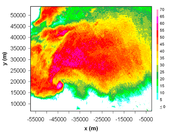
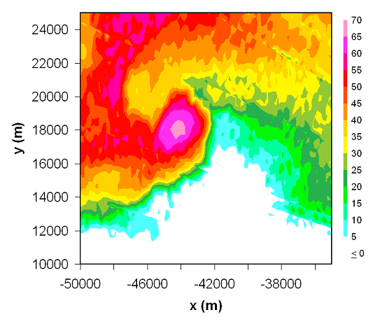
Now that we are starting some of the research on this outbreak…I wanted to show you a radar image of the tornadic supercell and the tornado itself when it was over a wooded area near the Tuscaloosa/Jefferson county line. The supercell is classic, except it has some features in it that I have never seen before.
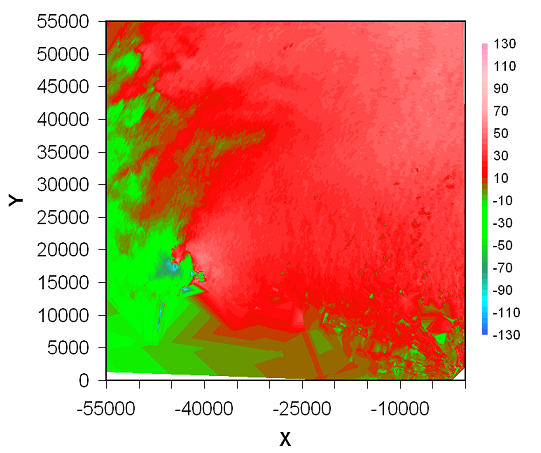
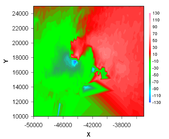
The vivid “debris ball”, indicating the tornado itself, is caused by debris (trees, lumber, etc.) being thrown upwards in the tornado, and the radar thinking they are very large hailstones. Another thing…often on NEXRAD and TV radars, the velocity cuts off at +/- 60 knots. The raw radar data do as well. But, using techniques here at UAH, we can unfold the radar data, showing that some of the pulses the radar thinks are inbound are actually outbound faster than 60 knots and vice versa. It’s a phase thing with a sine wave. Anyway, below are the unfolded, true velocity images (and reflectivity images) of the storm at 2233 UTC (5:33 pm CDT). The top two show the entire storm, the bottom two are zoomed in on the tornado.
The maximum velocity actually detected by the radar was 132 knots, or about 150 mph, near 1,500 ft. Typically, tornado winds are the strongest near the ground, so this is truly an incredible radar image, and one of the strongest winds ever observed by a NEXRAD radar.
Category: Met 101/Weather History


