The Big Picture
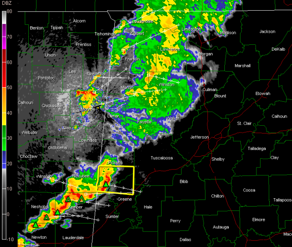
The good news is that there is just no instability across Alabama tonight.
There was quite a bit across Mississippi, but the storms are weakening as they move into Alabama.
We still have a severe thunderstorm warning for Pickens, northwestern Greene and northern Sumter Counties in West Alabama.
Those storms have definitely weakened though in the past few minutes. Even the lightning output has diminished a good bit. Still will produce some scattered wind damage though as they head east southeast through the warned counties. They will clip southern Tuscaloosa County, heading toward Hale County.
Unless there are some severe weather reports, the NWS will probably let this warning expire.
Hopefully we won’t see any others tonight, but we will be watching.
Moderate rain continues across much of Marion, Winston, Walker and Fayette Counties.
A rogue storm is behind the line near Smithville MS. It will affect Marion County shortly, but heavy rain, some lightning and gusty winds should be the main effect.
Category: Alabama's Weather, Severe Weather


