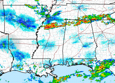
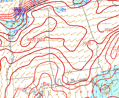
Storm analysis – 230 pm
…SEVERE THUNDERSTORM WATCH IN EFFECT…
Thunderstorms have exploded over the past 2 hours over northern MS and northern Alabama. These storms are forming ahead of a weak front.
The atmosphere is very unstable over north and central Alabama, with CAPE near 4,000 J/kg. This should allow the storms to continue to remain strong to severe as they move SE this afternoon.
There is also some dry air aloft on the sounding from this morning, so strong wind gusts (over 75 mph in a few places) are possible, in addition to large hail. The storms could arrive in BHM around rush hour, so keep an eye on the radar, and if you can leave work early to avoid driving in these storms, go ahead.
There is almost no wind shear with these storms, so we don’t have to worry about big tornadoes or anything. But, the intense lightning and strong winds will still be dangerous.
Category: Severe Weather


