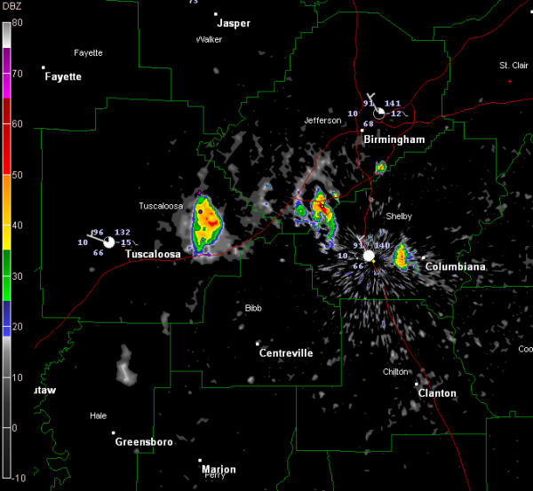
Storms Finally Make an Appearance
LATE REPORT: Calera [Shelby Co, AL] NWS employee reports HAIL of pea size (M0.25 INCH) at 05:15 PM CDT — intersection of cr 70 and us hwy 31.
So some hail as well.
A few storms have formed in the past hour south and southwest of Birmingham late this afternoon.
The strongest storm was over northeastern Tuscaloosa County north of I-20/59 north of Coaling and Vance.
There is another in the McCalla area of southwestern Jefferson County. It should stay west of Helena.
Another was developing between Columbiana and Alabaster.
Other storms were developing along I-65 between Pelham and Riverchase and near the Colonnade.
Looks like another cell is about to develop between Moundville and Greensboro in Hale County.
All of the cells are drifting southward.
They will contain sharp lightning, brief heavy rain and could produce some strong gusty winds.
Category: Alabama's Weather


