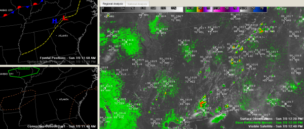
Widely Scattered Storms Forming over Central Alabama
Thunderstorms are starting to form along a surface trough that extends from Atlanta to Meridian this afternoon.
The heaviest concentration is over East Alabama’s Clay, Randolph, Coosa, Tallapoosa and Elmore Counties.
Further west, storms were s=forming near Calera, Moundville and between Livingston and Demopolis.
They are small in size, but growing quickly. They have a history of producing lightning rather rapidly.
They are moving southwest and will affect areas south of I-20 for the most part today. Areas north of that could see an isolated storm, but the best chances will be south of that.
Hot is the word. It was already 93F at noon at Birmingham, running two degrees ahead of the same time yesterday. Tuscaloosa’s 94F was two degrees behind yesterday, but they will probably still approach 101F.
Category: Alabama's Weather


