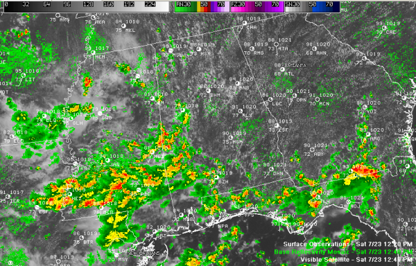
Almost Tropical Showers
Central Alabama greeted the day with a considerable amount of low cloudiness and fog. The stratus and stratocumulus was the result of deep moisture flowing into the area on southeasterly winds.
A few light showers began to form during the early morning hours, and they increased through the late morning over West and Southwest Alabama in the vicinity of a weakness in the atmosphere that extends into Mississippi, where storms were even more plentiful.
Morning lows were mainly in the middle 70s, except for Pinson, which was a little more refreshing, with an overnight low of 69F.
The clouds began to break up during the late morning in areas east of US-43. By early afternoon showers were starting to form in the rapidly warming atmosphere in the I-59 and I-20 corridors. I think this may be a favored area for shower and storm development through the afternoon and coverage should be about 40% in this area. Other areas will see more isolate development.
High temperatures will top out in the lower 90s in areas that haven’t seen showers this morning. Tuscaloosa had backed down to 79F just before 12:30 p.m. with a shower at the airport.
If you are lucky enough to see a shower this afternoon, it will dump heavy rain in a short period of time, possibly some gusty winds and some lightning.
Lightning was showing up around 12:45 to the east of Meridian, but with the high moisture content, the showers will be more tropical in nature and will probably feature less lightning than you would normally expect. One showers north of Livingston was finally started producing lightning just before 1 p.m. after it had grown to a height of 40k feet.
Category: Alabama's Weather


