Spot Reports Coastal and Offshore
These reports based on 7 PM, EDT observations
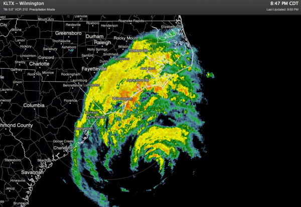
Composite radar and animated shows that Hurricane Irene is still well offshore but moving almost due north in the general direction of the North Carolina Outer Banks. Still quite a ways away however. Heavy rain bands are already onshore in the coastal sections of both Carolinas
* Waterfront Park, Charleston, wind north 24, gusts 33
* John’s Island…wind north gusts 36
* Hilton Head… partly sunny, wind north gusts 23
* Myrtle Beach…steady rain, wind north, gusts 38
* Savannah…cloudy, north 6 mph
* Frying Pan Buoy…wind NE 47, gusts 58, 26 foot waves and 20 foot swells
* Wilmington…steady rain, wind NE 31, gusts 44
* Southport…heavy rain, wind NE, gusts 45
* Cape Hatteras…rain, wind east gusts 25
* Morehead City…heavy rain, wind NE, gusts 29
* Johnny Mercer Pier, wind NE 49, gusts 59
* 27 miles SE of Wrights Beach…wind NE 43, gusts 52
BUOYS MORE THAN 115 MILES OFFSHORE
* 170 land miles east of Cape Hatteras…wind SE 27, gusts to 31 with 13 foot waves
* 300 nautical miles (345 land miles) south of Myrtle Beach…wind west at 28, gusts 31, 18 foot waves
* Nassau, Bahamas…wind SW at only 6 mph (all the bad stuff is over for them
Category: Alabama's Weather


