Irene… Jose! Katia?
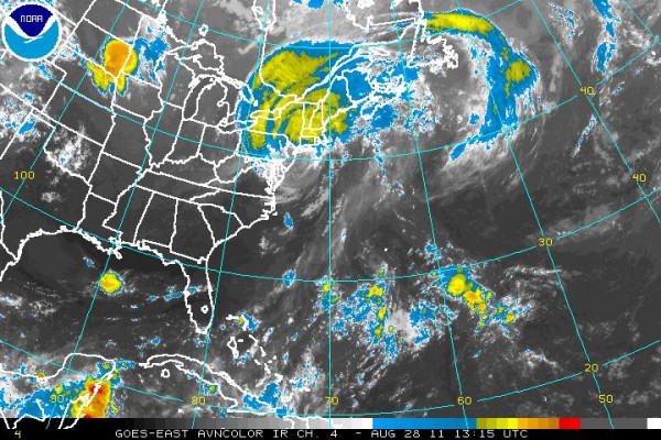
IRENE AND THE MEGAOPOLIS: Overnight and this morning, Irene has tracked just offshore of the mid-Atlantic coast. It made landfall very near New York City around 8:30 a.m. The windfield with Irene is very large, and strong tropical storm force winds are being felt over a wide area. This will lead to numerous reports of minor wind damage. Flooding will be the big problem, with widespread 6-10 inch rainfall amounts falling on already saturated ground. This will lead to significant flooding in many areas, and substantial river flooding over the next few days in places from New Jersey into New England. Irene should was just downgraded to tropical storm status and will lose tropical characteristics tonight over New Hampshire or Maine.
Here is the latest advisory on Irene…
WTNT64 KNHC 281302
TCUAT4
TROPICAL STORM IRENE TROPICAL CYCLONE UPDATE
NWS NATIONAL HURRICANE CENTER MIAMI FL AL092011
900 AM EDT SUN AUG 28 2011
…CENTER OF IRENE MOVES OVER NEW YORK CITY…
REPORTS FROM AN AIR FORCE HURRICANE HUNTER AIRCRAFT AND NATIONAL
WEATHER SERVICE DOPPLER RADAR INDICATE THAT THE CENTER OF IRENE
MOVED OVER NEW YORK CITY AROUND 900 AM EDT…1300 UTC. IRENE HAS
WEAKENED TO A TROPICAL STORM AND THE ESTIMATED INTENSITY AT
LANDFALL WAS 65 MPH…100 KM/H.
SUMMARY OF 900 AM EDT…1300 UTC…INFORMATION
————————————————–
LOCATION…40.7N 74.0W
ABOUT 0 MI…0 KM N OF NEW YORK CITY
MAXIMUM SUSTAINED WINDS…65 MPH…100 KM/H
PRESENT MOVEMENT…NNE OR 20 DEGREES AT 26 MPH…43 KM/H
MINIMUM CENTRAL PRESSURE…965 MB…28.50 INCHES
OVER-REACTION: In our hyperventilated media world today, it is so hard to compete for the attention of millions of people when they are under a threat. Officials in the Northeast did that effectively with Hurricane Irene. The forecasts were nearly perfect from the Hurricane Center. They prepared for the worst, and it didn’t happen. Six years ago today, the worst was looming, and not enough was done. The result was over 1,800 fatalities in Hurricane Katrina. Which is worse? I say hats off to officials in the Northeast for what they did. Going through a dress rehearsal like this for the big one every 10-15 years is not a bad thing.
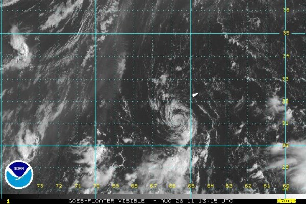
HEY JOSE: Tropical Storm Jose formed early this morning just south of Bermuda. Tropical storm warnings have been issued for the island. It will push north, passing just west of Bermuda and then dying over the cold waters of the North Atlantic.
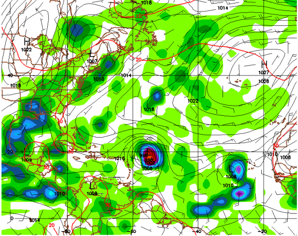
KATRINA’S REPLACEMENT: We are using the same list of storm names that were in use in 2005, with the exception of a couple that were retired, Katrina being the obvious one. Her understudy gets her spot on the stage next, and it looks like Katia could be a formidable hurricane by next weekend. The good news is that Katia will likely turn north and recurve without affecting any major land masses except perhaps the Canadian Maritimes. Still, it will probably produce some nervous moments along the East Coast in the days ahead. Hopefully that is all.
Category: Tropical


