Lee on the Coast
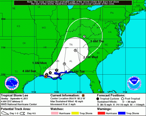
WTNT33 KNHC 040840
TCPAT3
BULLETIN
TROPICAL STORM LEE ADVISORY NUMBER 11
NWS NATIONAL HURRICANE CENTER MIAMI FL AL132011
400 AM CDT SUN SEP 04 2011
…CENTER OF LEE ON THE COAST OF SOUTHERN LOUISIANA…
SUMMARY OF 400 AM CDT…0900 UTC…INFORMATION
———————————————-
LOCATION…29.6N 92.5W
ABOUT 80 MI…125 KM W OF MORGAN CITY LOUISIANA
ABOUT 50 MI…80 KM SW OF LAFAYETTE LOUISIANA
MAXIMUM SUSTAINED WINDS…45 MPH…75 KM/H
PRESENT MOVEMENT…N OR 360 DEGREES AT 2 MPH…4 KM/H
MINIMUM CENTRAL PRESSURE…987 MB…29.15 INCHES
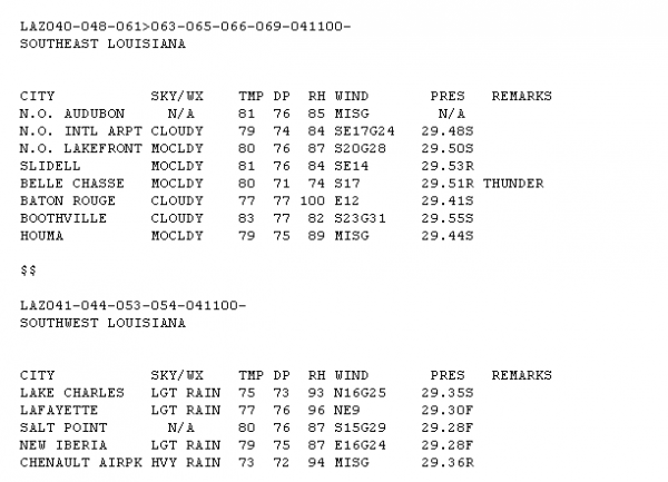
Winds are not very strong across southern Louisiana. Here are 5 a.m. observations…
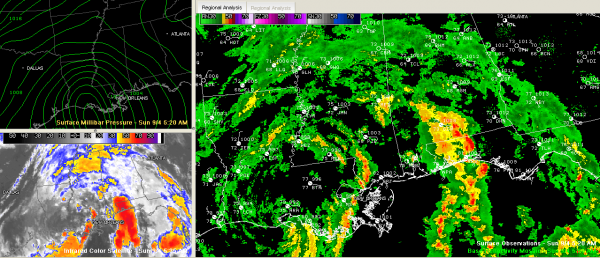
Across Alabama, showers are light, but they will be increasing in coverage and intensity through the day today.
A flash flood watch is in effect for all of Central Alabama.
There could be a few isolated weak tornadoes across southwestern sections today mainly down around Choctaw, Marengo and Dallas Counties in the outer feeder bands. They will spread a little further northward for Monday, with the main threat from Marengo an Perry through Chilton, Talladega and up into Cleburne Counties. Again, we emphasize they will be brief and weak, but could cause damage. Expect some warnings.
There will be a southeasterly breeze today, about 8-16 mph. It will continue tonight and increase on Monday. Winds will average 12-25 mph Monday, which is quite windy, with gusts over 30 mph. That won’t be strong enough to cause much in the way of damage.
Category: Alabama's Weather, Tropical


