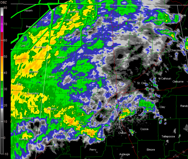
Update at 1:45 a.m.
The NWS has extended the tornado watch area to include Autauga, Dallas, Greene, Hale, Lowndes, Montgomery, Perry, and Pickens Counties till 7:00 AM CDT. The tornado watch continues for Marengo and Sumter Counties as well.
There are two tornado warnings in Mississippi and a tornado warning in Southwest Alabama for Choctaw and Washington Counties. That radar indicated tornado was near Citronelle.
In Central Alabama, heavier storms right now extend from Shelby through Bibb, Tuscaloosa and Pickens Counties right now. Elsewhere, rain is generally west of I-65 and north of a line from Livingston to Greensboro to Centreville at this hour.
The heaviest weather continues in Mississippi where intense rainfall is falling now from Tupelo and Columbus down to Jackson and Vicksburg with a strong feeder band to the coast. Three to five inches of rain has occurred across much of Central Mississippi and another 3-5 inches is expected over then next few hours. Creeks are reportedly rising in Jackson.
The center of Tropical Depression Lee is just south of Baton Rouge at this hour. A stationary front now extends from Nashville to Muscle Shoals to Jackson to the low, then on to east of Houston. The low should begin to move northeastward along the front. It is likely that Lee is losing or has lost tropical characteristics.
Category: Alabama's Weather, Severe Weather


