The big chill – update
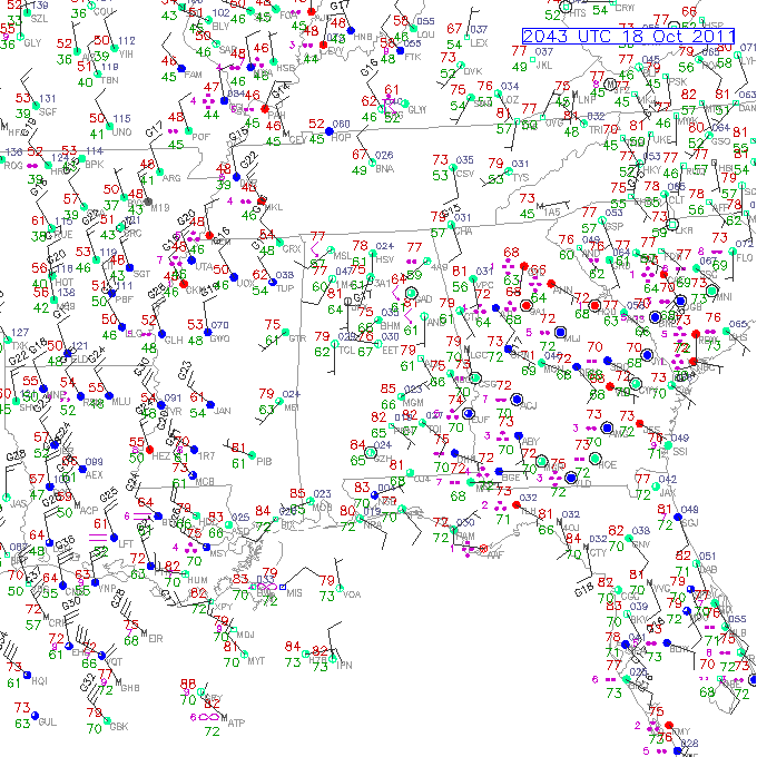
The big-time cold front we’ve been talking about since last week is just now entering NW Alabama. When it moved through Muscle Schoals, the temperature dropped from 77 to 62 in one hour (temps above are from 3 pm)! Memphis has been in the 40s for much of the afternoon, with wind chills near 40. A few strong storms have fired ahead of that front, and we may see a few scattered, strong storms as the front moves through TCL/Cullman/BHM this evening. Storms may be fewer in east Alabama as the sun goes down.
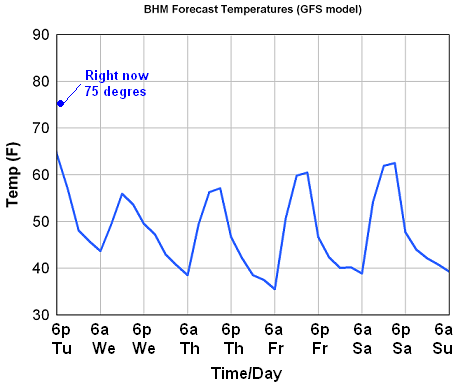
The big story is the cold air. The models still differ on how aggressively the cold air will come in, but given the rapid SE movement of it today and how cold it has been in Arkansas, Missouri, and west Tennessee today, the aggressive approach may turn out right. Here is the GFS forecast for temperatures in BHM over the next 4 days:
Temperatures will drop into the upper 40s by tomorrow morning over central Alabama, and with clouds, wind, and maybe some drizzle, we will hold in the 50s all day. Wind will make it feel like the 40s at times. Temperatures will then drop well into the 40s tommorrow night, and into the 30s Thursday night, probably the coldest night. With lighter winds by Friday morning, many spots as far south as Clanton may get frost, and colder valleys in NE Alabama could get a light freeze.
This will be a big change, from near 80 with partly cloudy skies today and yesterday, to cloudy and feeling like the 40s at times tomorrow with the wind figured in. Most people’s heat may kick on by tomorrow night.
Category: Alabama's Weather


