Update – 109 pm
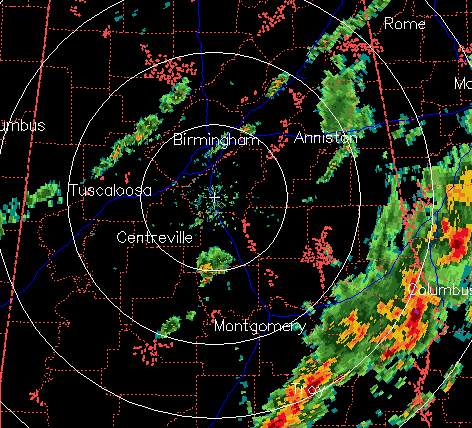
The severe storms from this morning have now pushed into southeast Alabama, south of Montgomery and Auburn, well ahead of the cold front. There may still be a few severe storms/isolated tornadoes in southeast Alabama this afternoon, but as far as here in TCL/BHM/GAD/ANB/HSV, the wind shear has greatly decreased as surface winds are now from the SW, so the threat for tornadoes in north, central, and west Alabama is basically over.
At least three tornadoes have been reported and caused damage that I am aware of…one in Demopolis, one on north Blvd in Montgomery, and one near Auburn University (no injuries reported at this time).
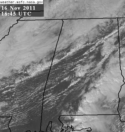
However, the air ahead of the front (shown well by the narrow band of showers/storms from Colony to Northport) is still moist and a little unstable, and with some sunshine ahead of the front this afternoon (see satellite picture below), temperatures will warm into the upper 70s or lower 80s in some spots before the front arrives. This will allow some spots to get one or two more brief episode of heavy rain and storms, but these should not, in general, be severe, and tornado risk is extremely low. About 30 seconds of hamburger-sized raindrops just fell here in Trussville.
Category: Severe Weather


