Model Madness Notes
We remain on a holiday schedule… you can watch the morning Weather Xtreme video for the long details on coming weather…
WEEKEND: No real change… a few showers could pop up tomorrow afternoon, but the main rain event comes tomorrow night into Sunday morning. The NAM is printing 0.98″ for Birmingham, and we believe most spots will indeed get around one inch of rain. Much colder air blows in here Sunday, with temperatures holding in the 40s much of the day.
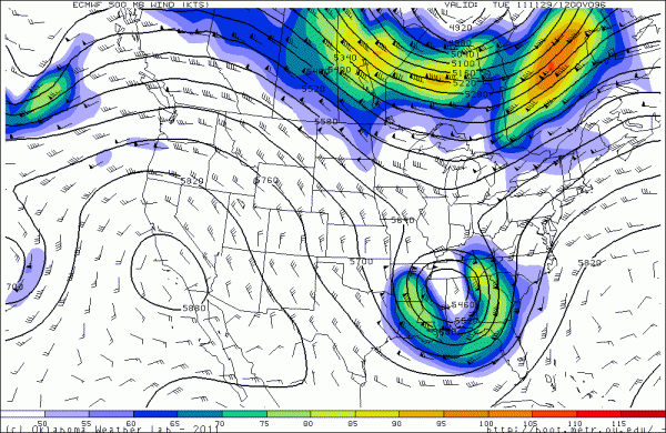
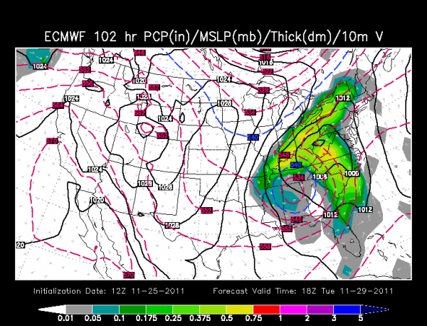
NEXT WEEK: The GFS is clearly an outlier now, with the GEM, the UKMET, and the ECMWF showing a deep cut-off upper low moving over Alabama. See the ECMWF output for Tuesday below…
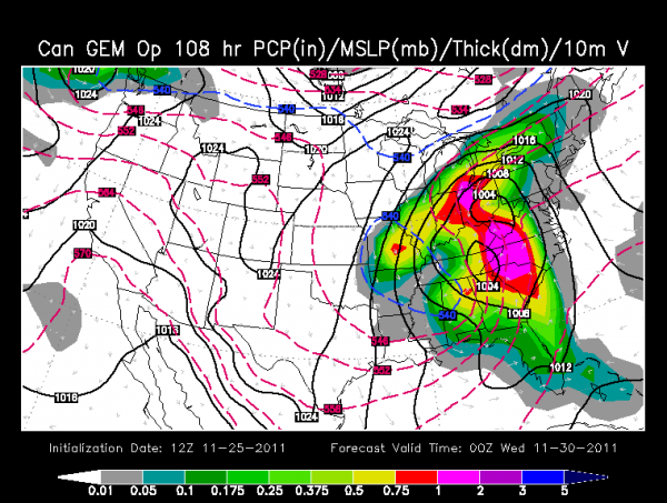
And, the Canadian for Tuesday…
If you believe the GFS, our weather will be sunny Monday and Tuesday with a warming trend. But, believe the Euro, and those two days will be mostly cloudy and cold with a chance of light rain at times. And, the 1000-500 mb thickness values drop to 5340 meters during the day Tuesday, meaning a snow flake sure can’t be ruled out at some point during the ULL visit to Alabama. But, the low level thickness values barely support snow flakes reaching the ground.
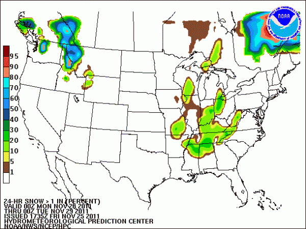
See the snow probability graphic here from HPC for Monday…
BOTTOM LINE: I think we need to go with a cloudy and cold forecast Monday and Tuesday with a chance of occasional light rain… then improving weather follows by Wednesday.
I hope you are enjoying this holiday having some fun, eating leftovers, and watching football! And, of course, a visit to the weather blog mixed in…
Category: Alabama's Weather


