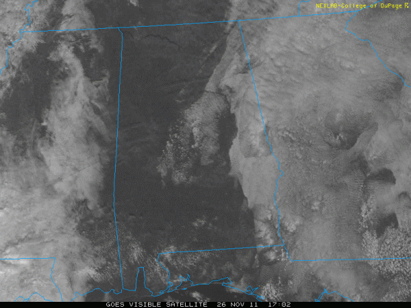
Nice Saturday in Progress!
Low clouds greeted the day across parts of the area this morning, but sunshine has been increasing from the west.
At lunch time, skies were generally clear west of I-65 with just some high clouds streaming across South Central Alabama. Stratocumulus clouds were breaking up from Hale and Perry counties northeastward to near Birmingham and Gadsden and points east. Clouds were thickest near the Georgia border.
To the west, clouds are massing over Mississippi and will move in late today.
We started off in the upper 40s to lower 50s this morning and will rise into the lower 70s this afternoon. Quite nice!
Rain will not be a problem for the Iron Bowl. Clouds are hanging tough now, keeping temperatures down. It’s 63F at Auburn right now, but 76F at Montgomery, which is in full sun. The clouds will break up a bit late in the afternoon. The temperature at kick off should be 68F, only falling a couple of degrees by the end of the game. Winds will may be a factor during the game, averaging 7-15 mph, but it doesn’t look like they will be as strong as earlier thought since our storm system has slowed down a bit. There could be a small shower during the game, but the chance is correspondingly small (less than 10%).
Model runs recently have been slowing down the arrival of the rain. The rain may not reach Northwest Alabama until midnight (or later). It will spread slowly across the state during the overnight, not reaching I-65 until sunrise or so. We should have a steady rain across much of the area all day on Sunday. Rain could be heavy at times.
The cold front won’t arrive until afternoon. Overnight temperatures will hover around 60F and we won’t get much higher than that during the day on Sunday. In fact, we western sections will see temperatures dropping by afternoon. The rain will continue through much of the afternoon, ending from the west Sunday evening. Before the main rain event is over, we should average between 1.5 and 3 inches of rain across the area. Some spots over the Tennessee Valley could see in excess of four inches!
We will see a rain/snow mix over North Alabama behind the main system starting Monday afternoon into Monday night and perhaps even Tuesday morning. Precipitation is not expected to be widespread, but an upper level low like the one we will see form over the South can create some surprises. So, we are calling for no accumulations, but it won’t be a surprise to see a few spots pick up a dusting (and maybe even more). We will have a hard time getting very far into the 40s on Monday after dropping well into the 30s Sunday night. Monday night will be cold as well, with lows in the lower and middle 30s.
Category: Alabama's Weather


