

Snow Showers – Kinda Like Thunderstorms!
The snow showers we’ve seen over much of Alabama this morning are a little bit like thunderstorms, in that they were brought on partially by unstable air near the ground. I know we think of unstable air as warm and humid, but as long as the temperature decreases quickly with height, it can be unstable.
Take a look at the UAH MPR temperature profiles vs. height and how they’ve changed since 0 UTC (6 pm last night).
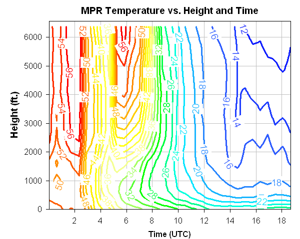
You can see the rapid inflow of cool air overnight, with the entire atmosphere (at least below 6,000 feet) from the time of the cold front (0230 UTC, or 8:30 pm), through this morning around 10 UTC (4:00 am). After that time, the warm ground started to release a little of its heat at low-levels, while cold air continued to come in above 1,000 feet. Then, once sunrise occurred, even though it has been cloudy, a little bit of the sun’s energy came through and warmed the ground a little more (see sun energy vs. time below). These two factors caused the air to become unstable between 4 am and noon (notice the rapid drop in temperature with height, from mid 20s at the surface to teens at 500 feet. Believe it or not, this rapid temperature drop with height is almost what we see in the summer!
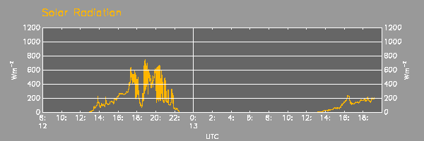
Solar Energy, yesterday and today.
This set up convective bands over the state, which you can see on satellite below. In the bands, light snow fell. Very neat.
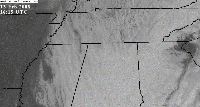
You can also see narrow bands of drier air in the lee of some of the mountains in NE Alabama and E Tennessee.
Category: Met 101/Weather History
About the Author (Author Profile)
Subscribe
If you enjoyed this article, subscribe to receive more just like it.


